


Paths and Travels in Friuli Venezia Giulia
Alpe Adria
MTB Friuli
Become a member
Paths and Travels in Friuli Venezia Giulia
26th Jun - 2nd Jul, 2023
Zone: 
Physical effort:: 
Technical effort: 
 Tabacco Map: /

What's that
The name is sufficiently self-explanatory and comes from the historical name of the region crossed: Alpe (mountains) - Adria (Adriatic Sea). Now the journey crosses two countries; until not many decades ago, it was all united.
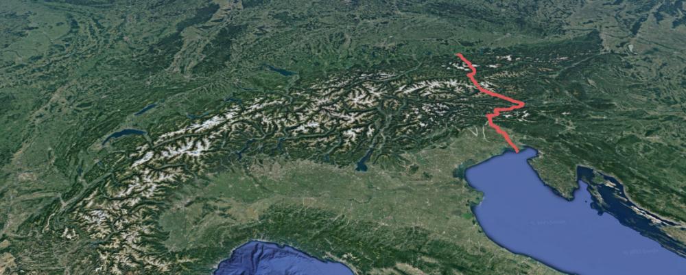
The journey connects the cities of Salzburg, on the 8northern Austrian border near Germany, and Grado, located on the southern island of Friuli (Italy) and at the top of the Adriatic Sea.
The stages have been developed in such a way as to travel Alpe Adria with tents, so always ending at structures where it's possible to camp. This doesn't prevent the use of hotels, gasthofs, B&Bs,..., modifying the layouts as desired.
Please note: the MTB Friuli route contains small deviations from the official route, mainly to explore the centers of different cities.
Another note is that the Alpe Adria can be done in both directions: from Salzburg to Grado and vice versa. MTB Friuli has chosen the first option due to face some uphills instead of others and the symbolic "return to the homeland".
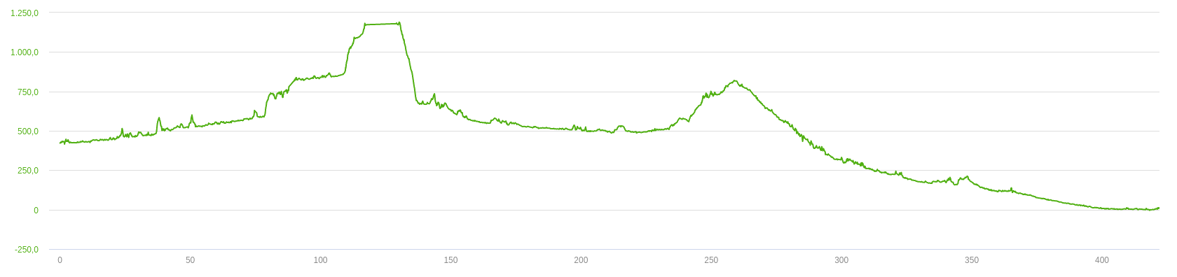
MTB Friuli's Alpe Adria was developed to be done in a week: 7 days of biking. The first and last are shorter, this in order to allow transportation to the starting or finishing point.
Below, the development of the travel split into 7 stages:
| Stage | LengthL (km) | Elevation Gain D+ (m) |
|---|---|---|
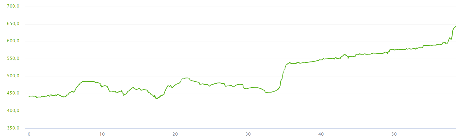
| 1st Stage: Salzburg - Hallein | 17 |
50 |
| 2nd Stage: Hallein - Sankt Veit im Podgau | 59 |
400 |
| 3rd Stage: Sankt Veit im Podgau - Obervellach | 50 |
800 |
| 4th Stage: Obervellach - Villach | 77 |
400 |
| 5th Stage: Villach - Chiusaforte | 72 |
450 |
| 6th Stage: Chiusaforte - Udine | 76 |
350 |
| 7th Stage: Udine - Grado | 56 |
50 |
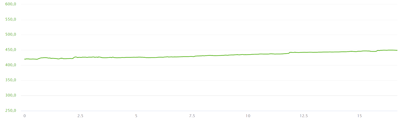
| Total | 406 |
2400 |
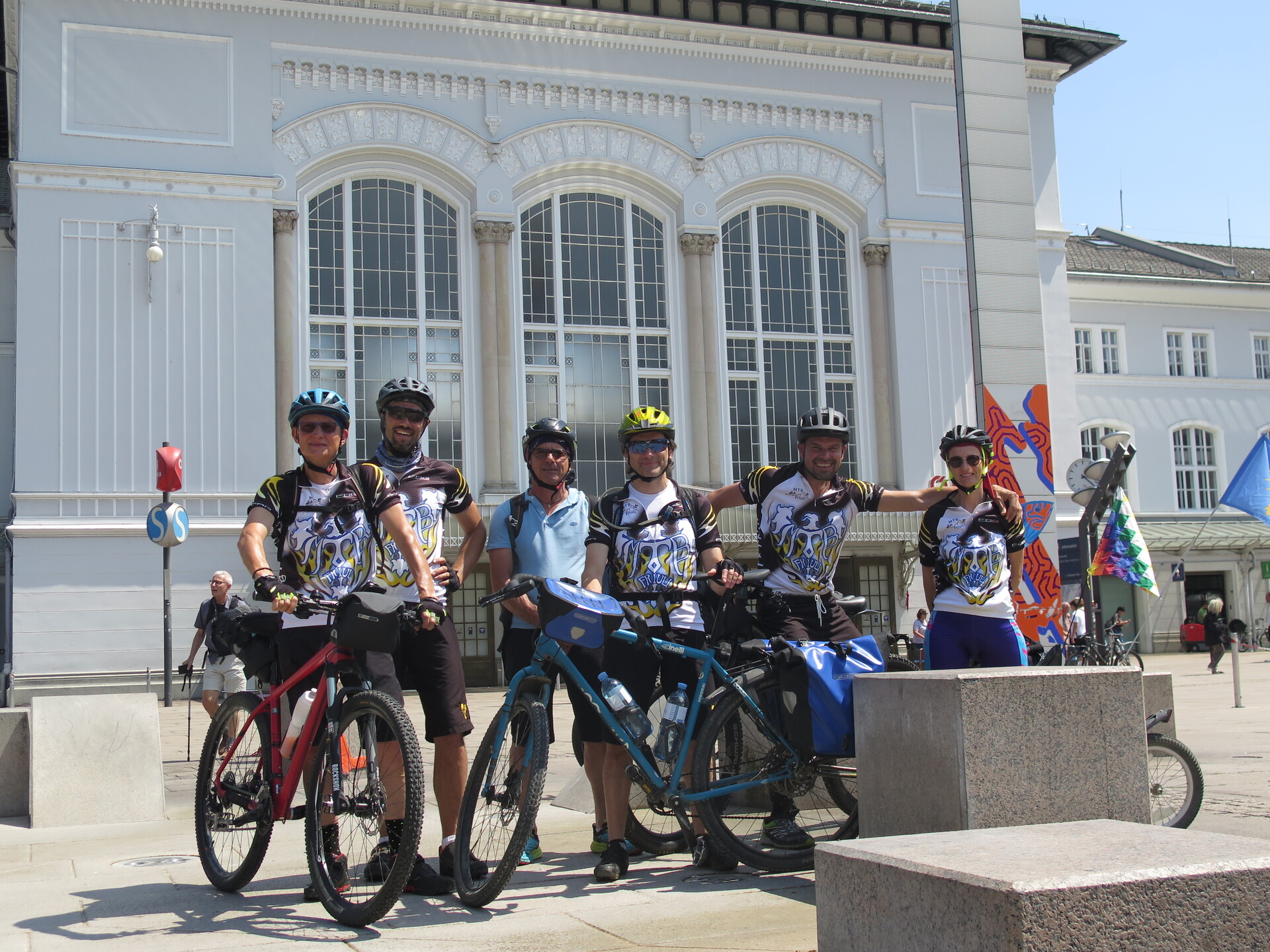
The beginning is at the Udine train station, so to reach Salzburg in half a day by train. All lines are able to transport the bikes, better with a reservation.
From the forecourt of the historic Salzburg station, we set off towards its centre, passing by the cathedral, under the castle and along the magnificent central square.
A flat first stage takes you to the first campsite in less than 20km; a symbolic warm-up for the next stages.
Yesterday, during the journey on the train you've seen valleys and hills where Alpe Adria passes through. Today we retrace them in reverse, gaining altitude. The first half of the stage takes place on the slopes of the Salzalc valley, avoiding the valley floor. Then, you go up to Lueg Pass, from where a long part on asphalt follows. The uphill to the village of Werfen tells you that you're in the middle of the stage. From now on, you can continue with a slight and constant slope to the end.
Well, those ahead are the High Tauern and we have to go to the other side. This stage is the shorter due to the height difference to be faced. Initially you find series of ups and downs, just up to the first long tunnel. Then, constant development up to the foot of Bad Hofgastein. There instead you are in the most difficult ascent of the trip where you have to conquer the waterfalls. More moderate, the uphill proceeds to the Tauern tunnel station where a train will take you to the other side of the mountain range.
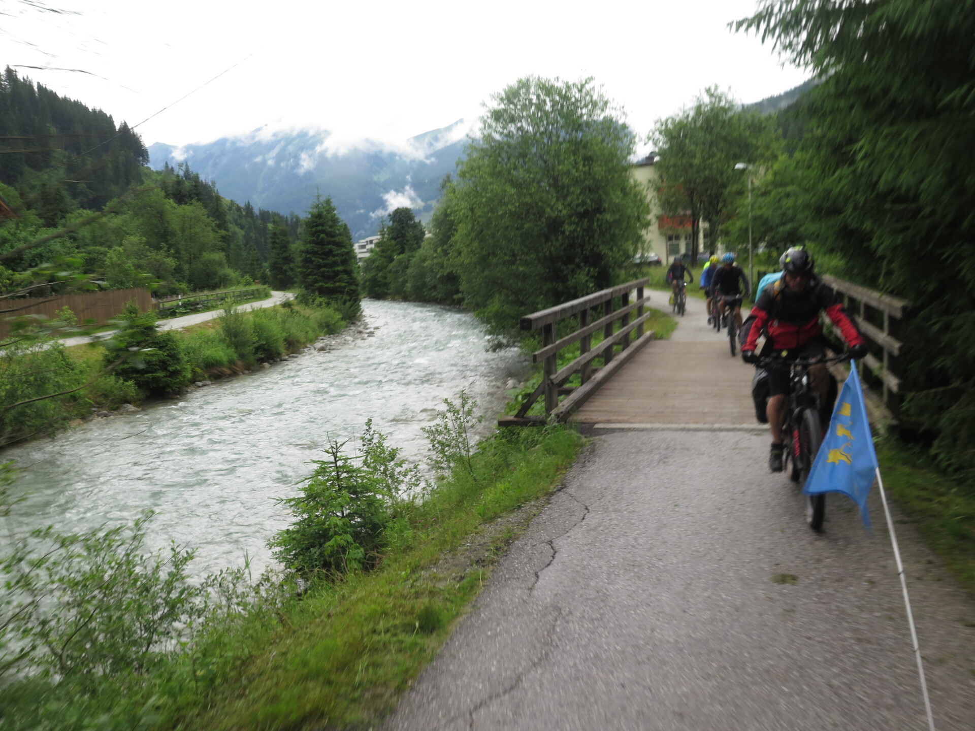
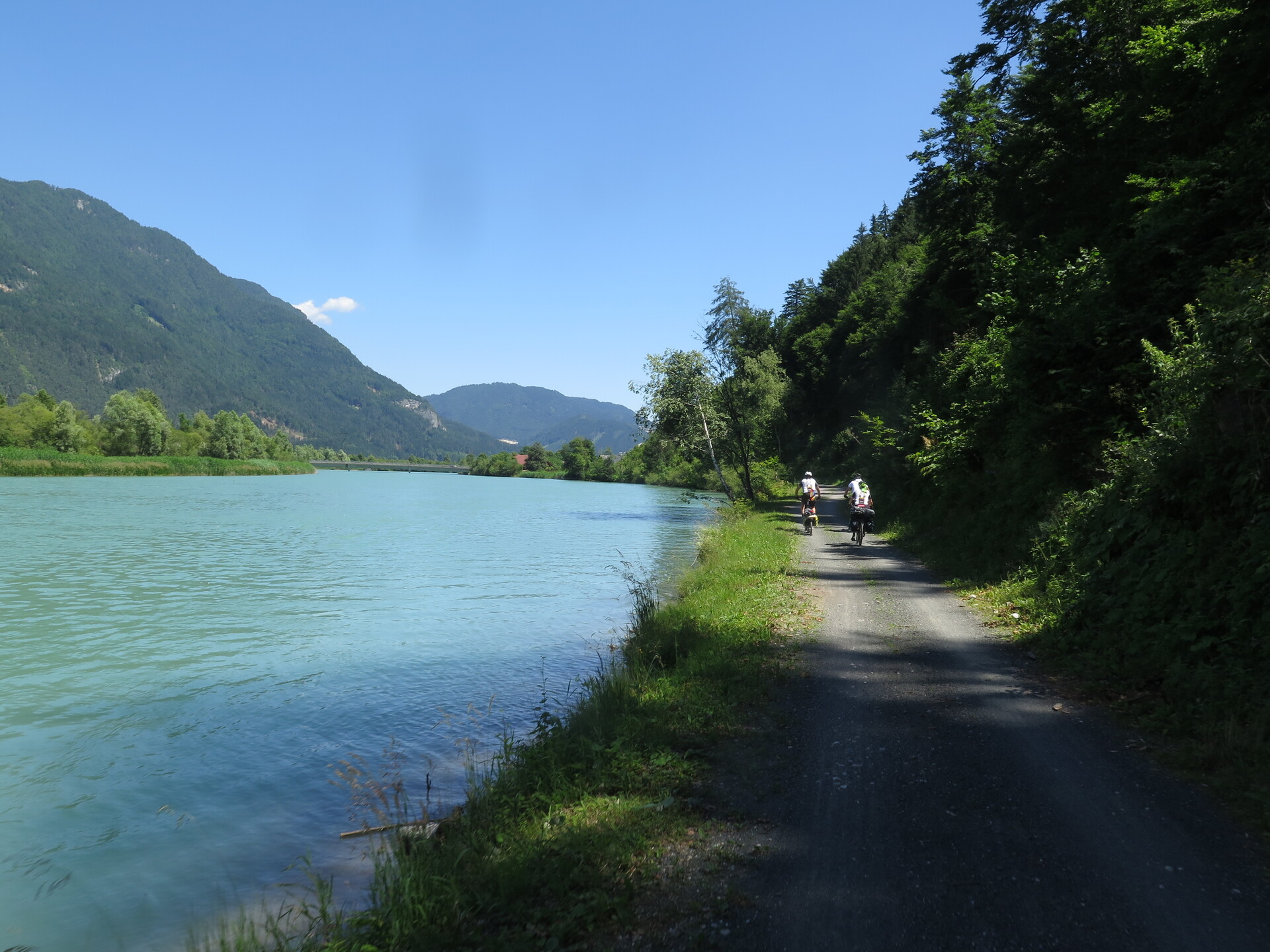
The lengthens stage so to reach the capital of the Carinthia region. Initial ups and downs with hilly style, let you gain the long descent beside the Drava River (Drau River) and arrive to the city. With 77km, it is the longest stage of the journey. Despite this, there are no technically difficult parts and you travel mostly on cycle paths.
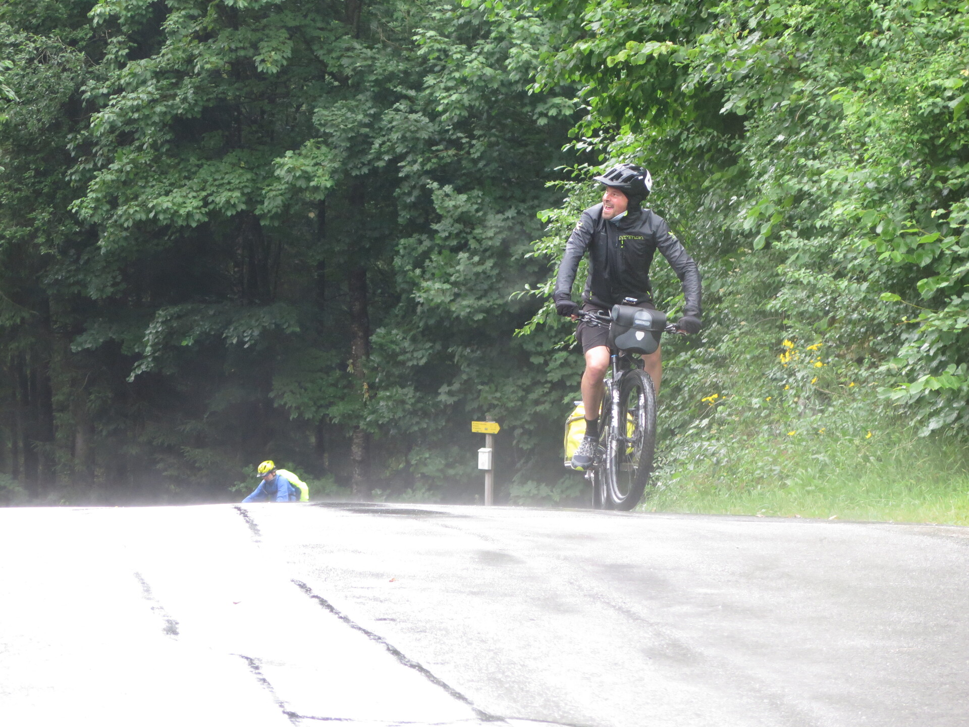
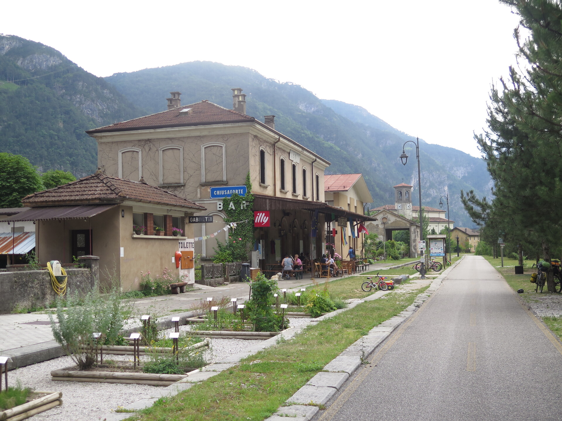
In the 5th stage we cross the border and return to Italy. An ascent without difficult parts allows you to gain altitude for the second (and last) major climb of the Alpe Adria. The Austria - Italy borderline is the passage of the state, instead Camporosso town is the transfer to the descent and to the most beautiful segment of Alpe Adria. This parts proceeds between high bridges and tunnels, views of the Fella River and the Julian Alps. In short, you run in descent just to gain time to spend looking at the views.
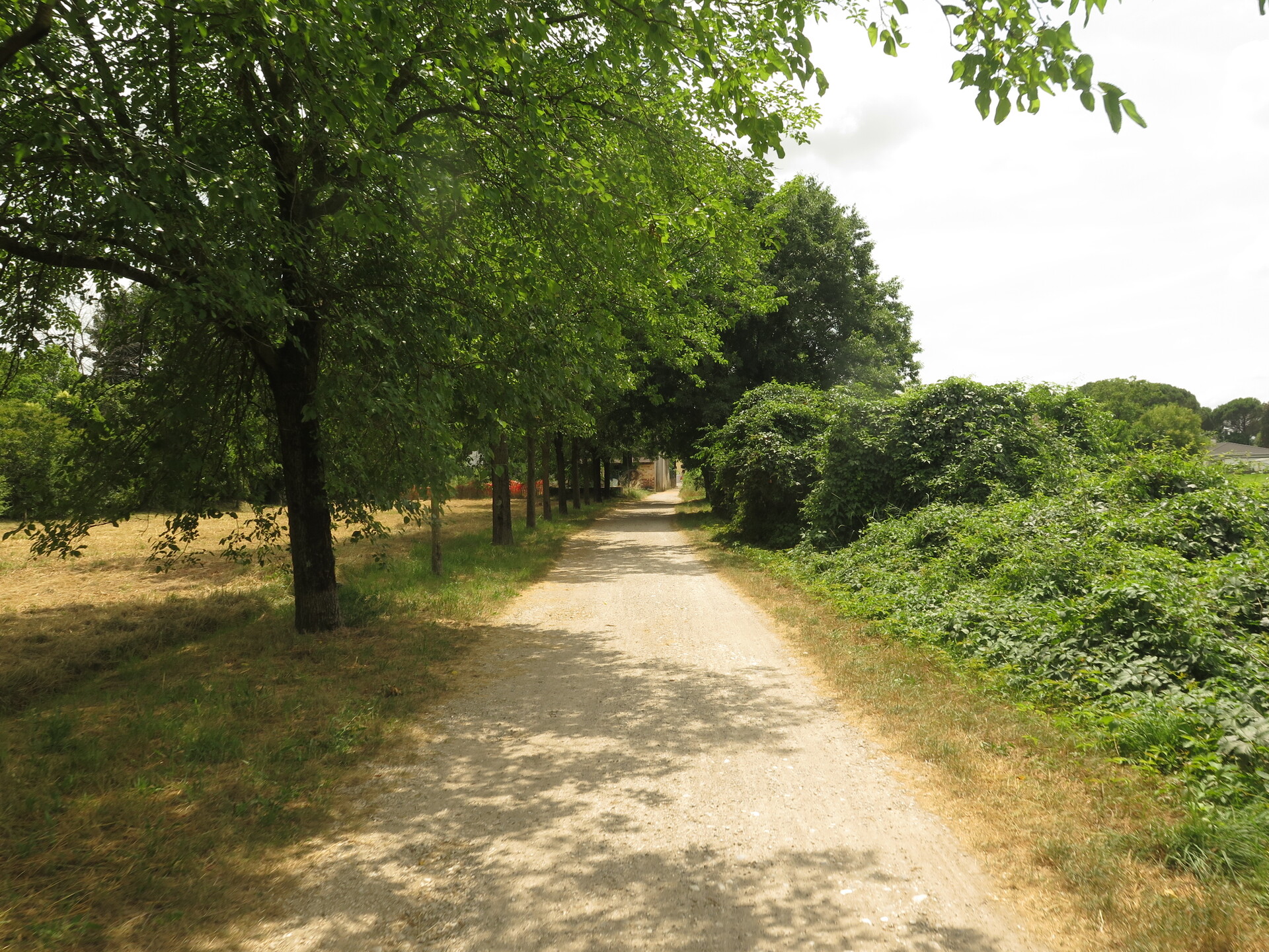
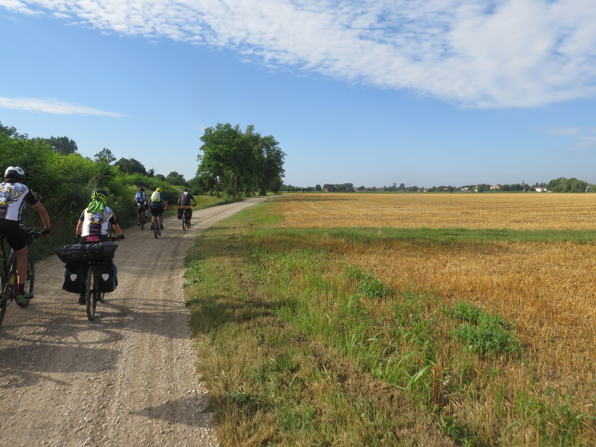
Another long stage, 76km, with the ups and downs of the Friulian hills. Nonetheless, it lets you ride quickly and gain time to be able to visit historic cities such as Venzone and Udine. There you find historic churches and castles scattered around the cycle path and different natural environments. This stage contains a good part on asphalt; although it could not be very pleasant for mountainbike lovers, it allows you to speed up (and shorten) the stage.
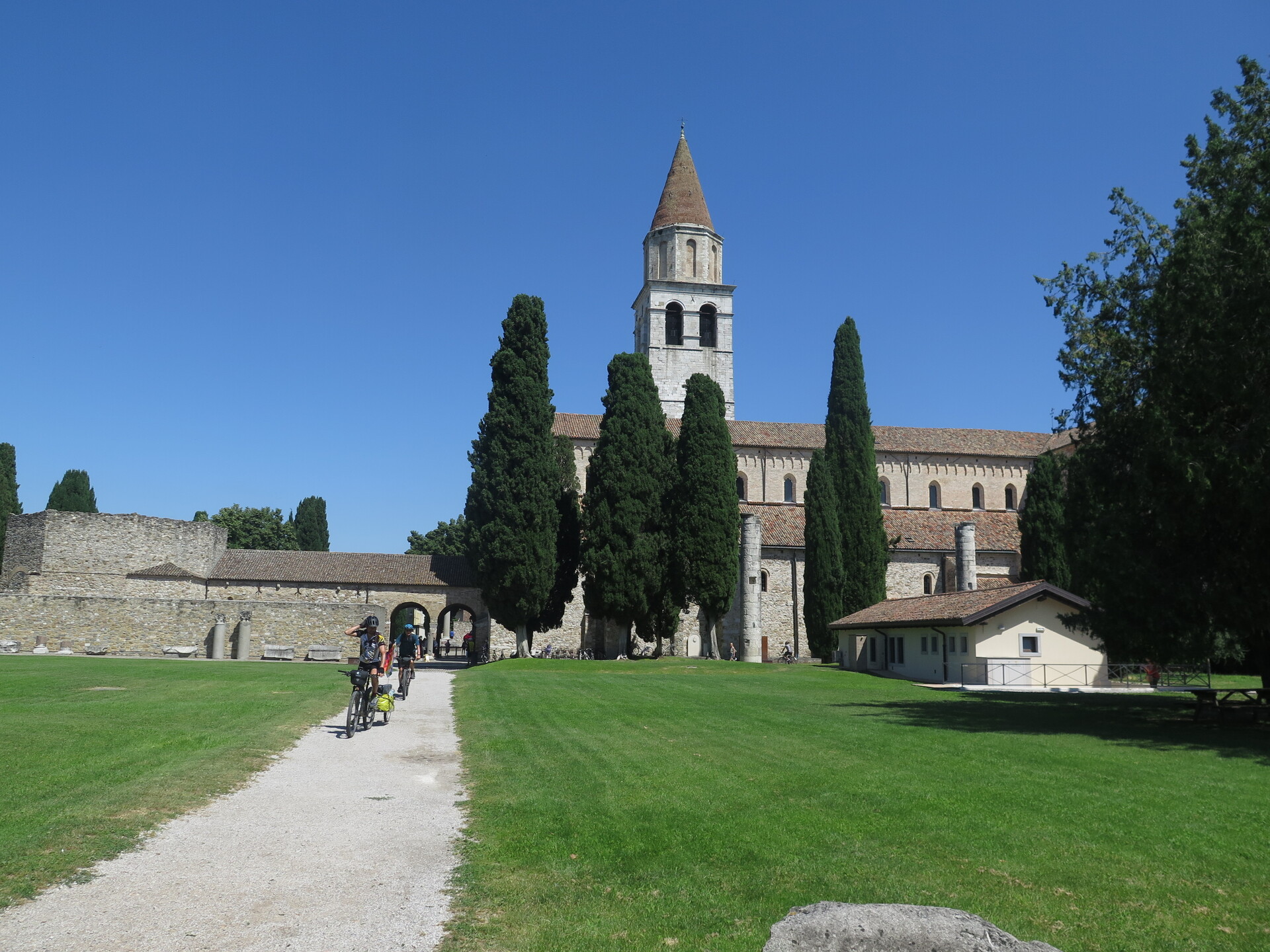
Last, but not the least. In fact, this day explores the Friulian countryside through historic villas, the walls of the historic Unesco city of Palmanova, the Castle of Strassoldo so to reach the spectacular historic Unesco city of Aquileia. It is not enough? A few kilometers more on the lagoon to arrive to the historic center of Grado, the old Venice, whose style can be noticed. And then the sea: yes, we have reached the Gulf of Trieste, the Adriatic Sea.
The whole mountain part can be closed during the winter due to the snow. The flat part instead can be really hot during the months of July and August.
Alpe Adria is one of the simplest bike travels in the MTB Friuli library: although the lengths of the stages are not insignificant, on the whole journey there were no technically difficult sections.
 , Physical technical
 , Physical technical
 , Physical technical
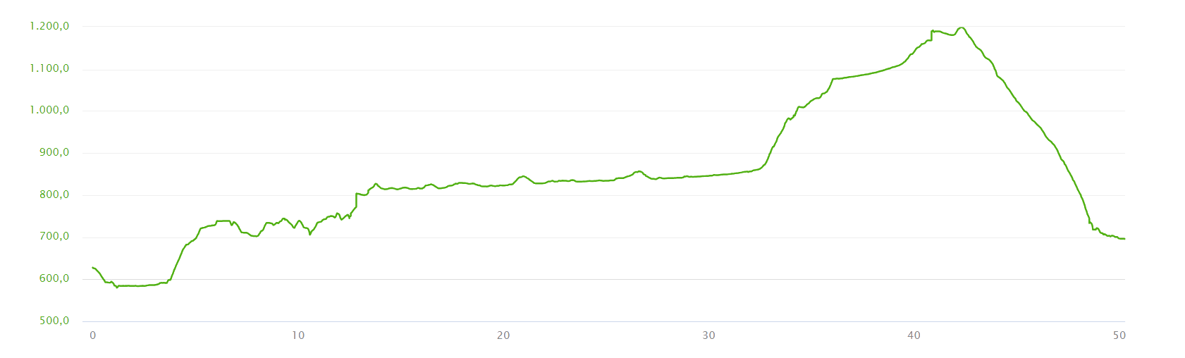
, Physical technical 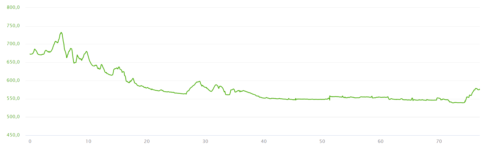
, Physical technical 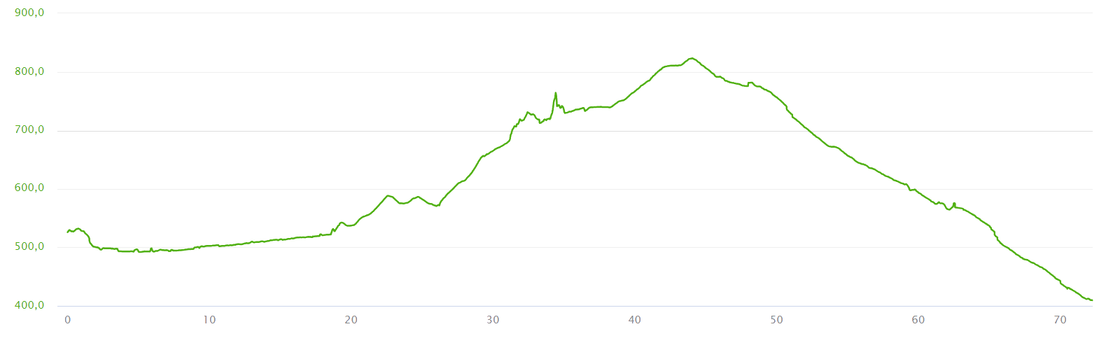
 , Physical technical
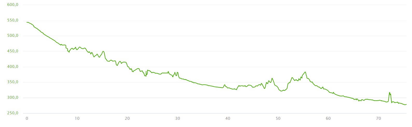
, Physical technical 
Track's picture and video
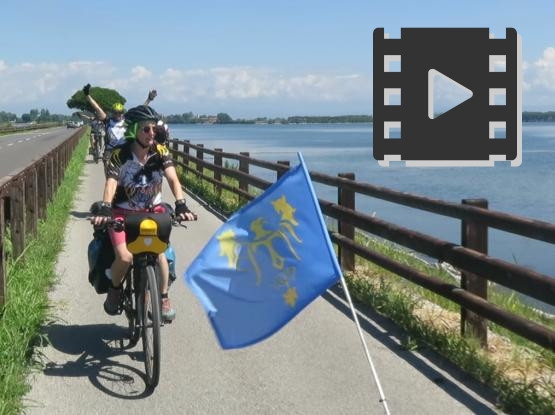
One week in a minute.
Alpe Adria trip trailer.
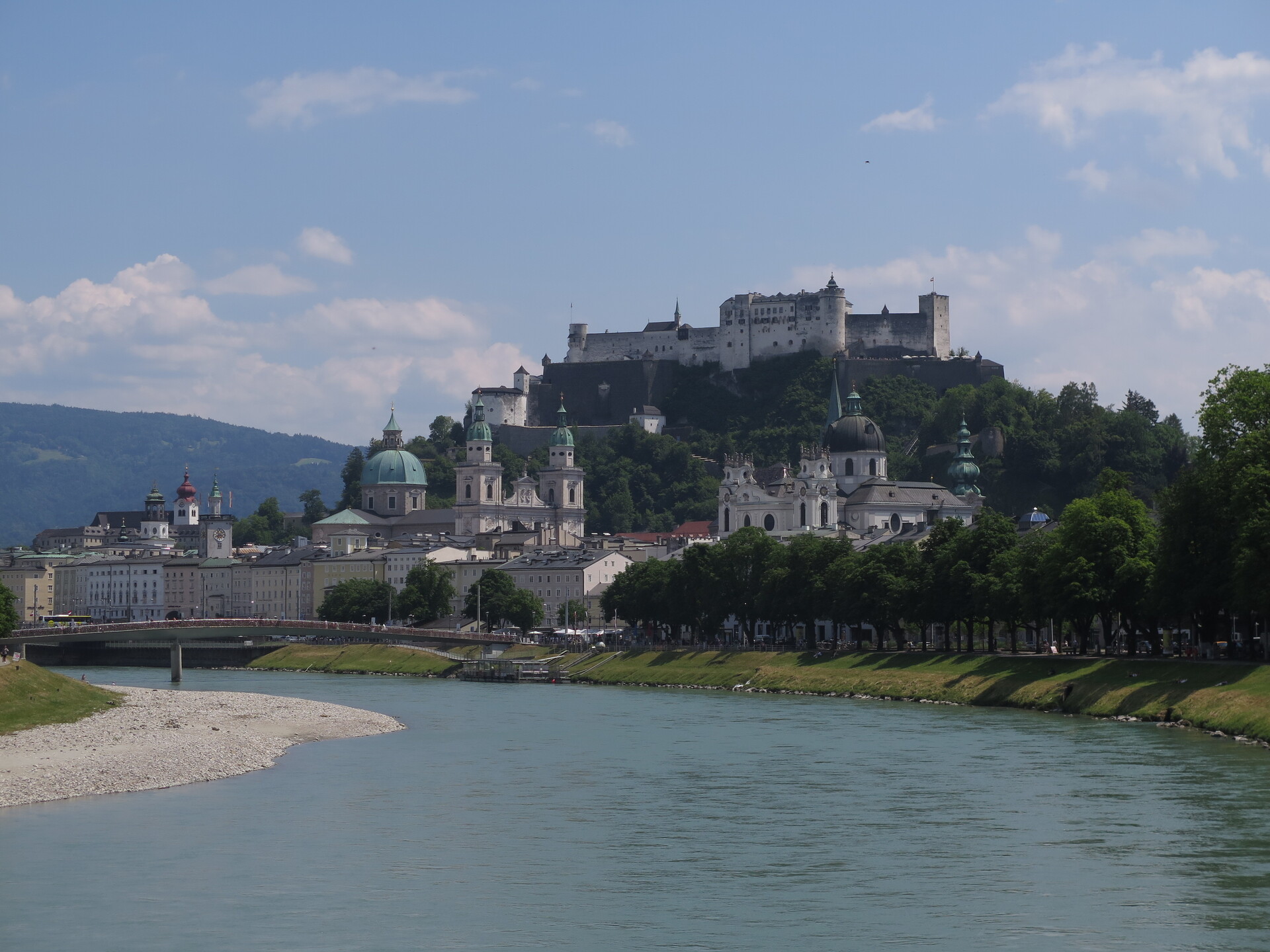
The Salzach River with Salzburg Castle in the background.
The beautiful old town is crossed.
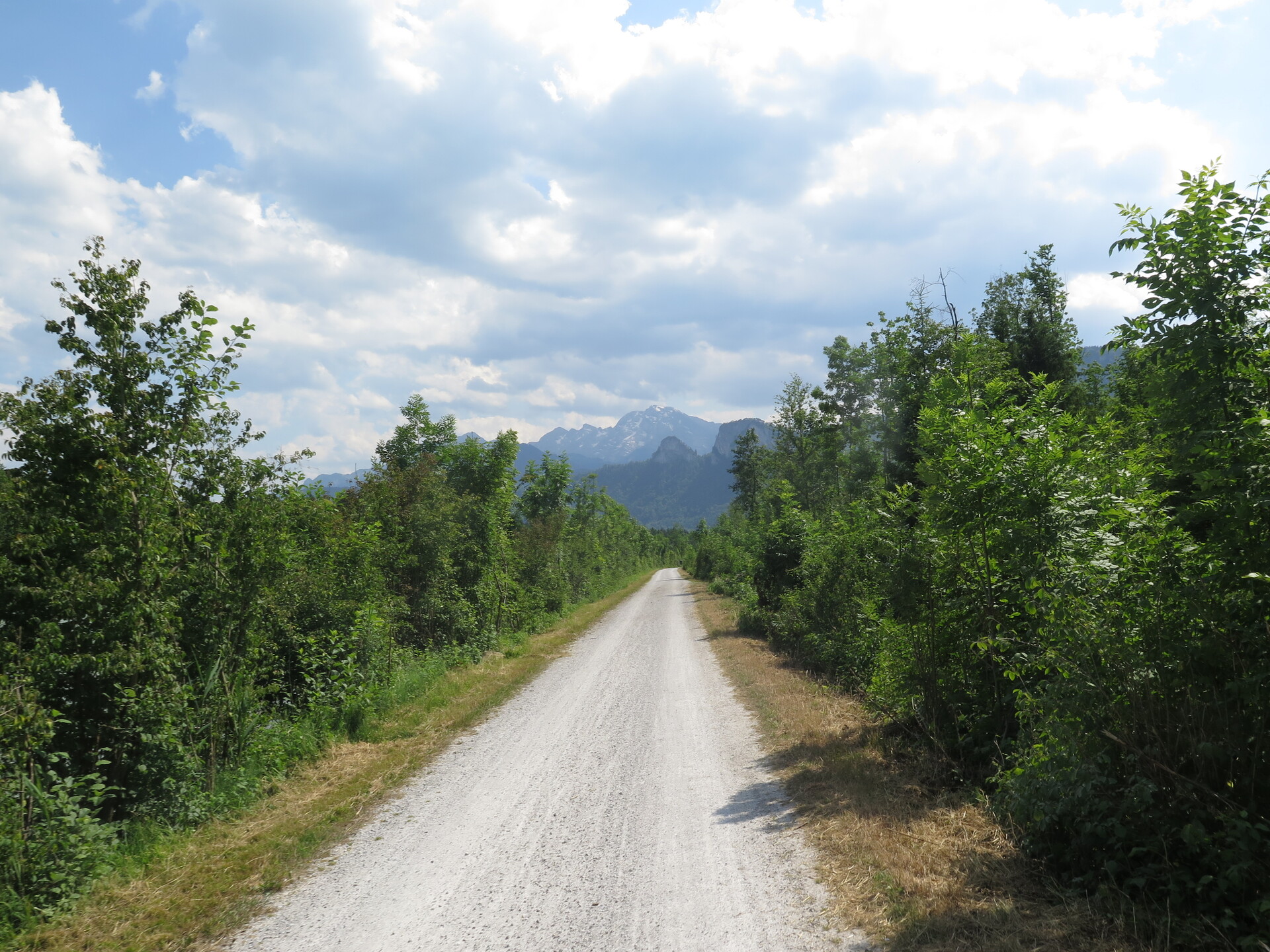
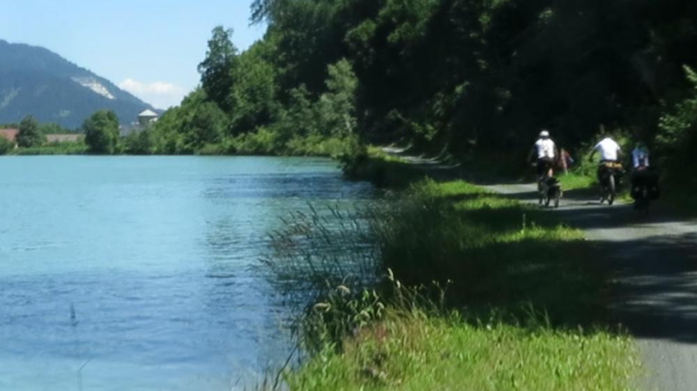
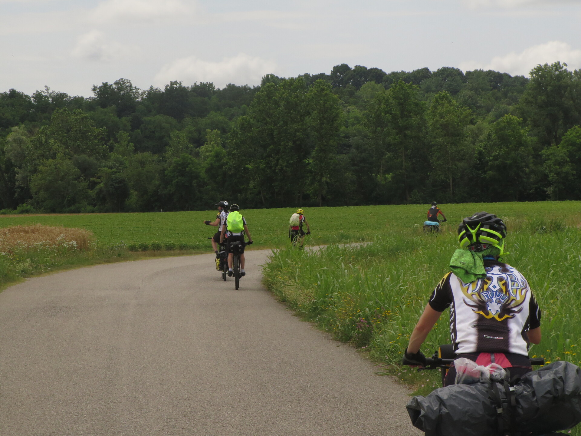
Example of part of a cycle path: dirt road with trees around it.
View of the Hohe Tauern, mission of the second and third stage.
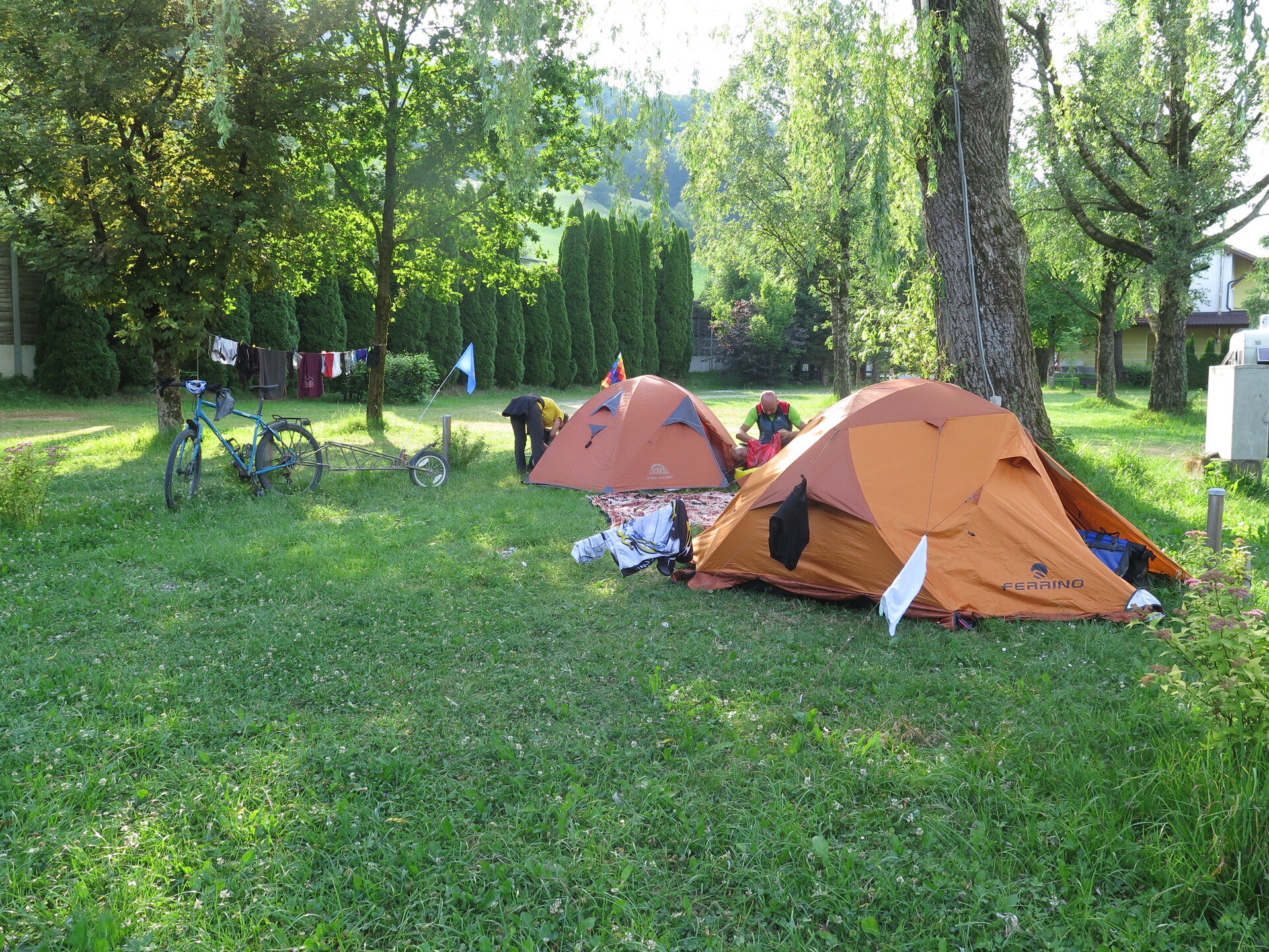
The track travels from campsite to campsite.
Easily editable itinerary with B&B and hotels.
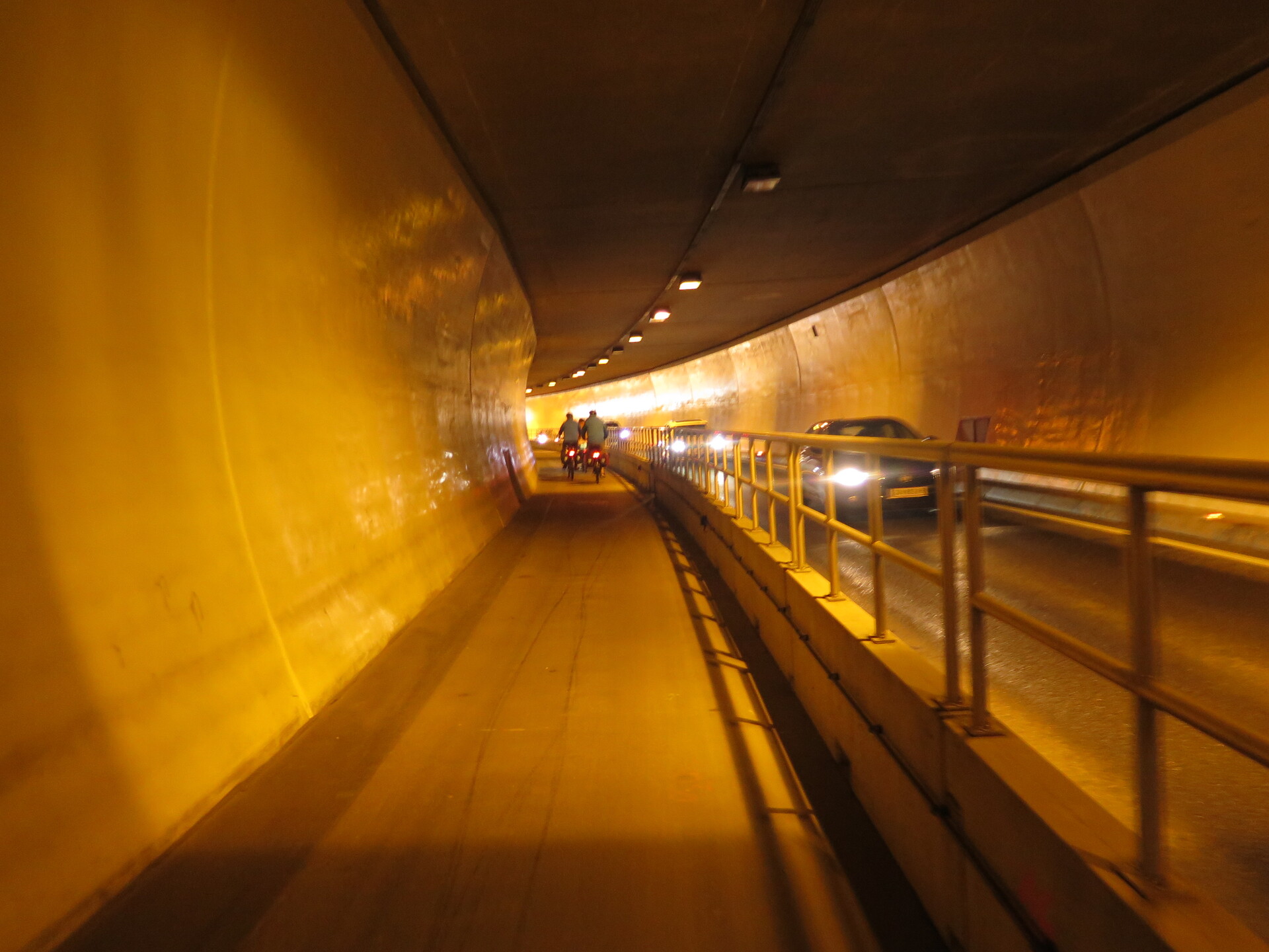
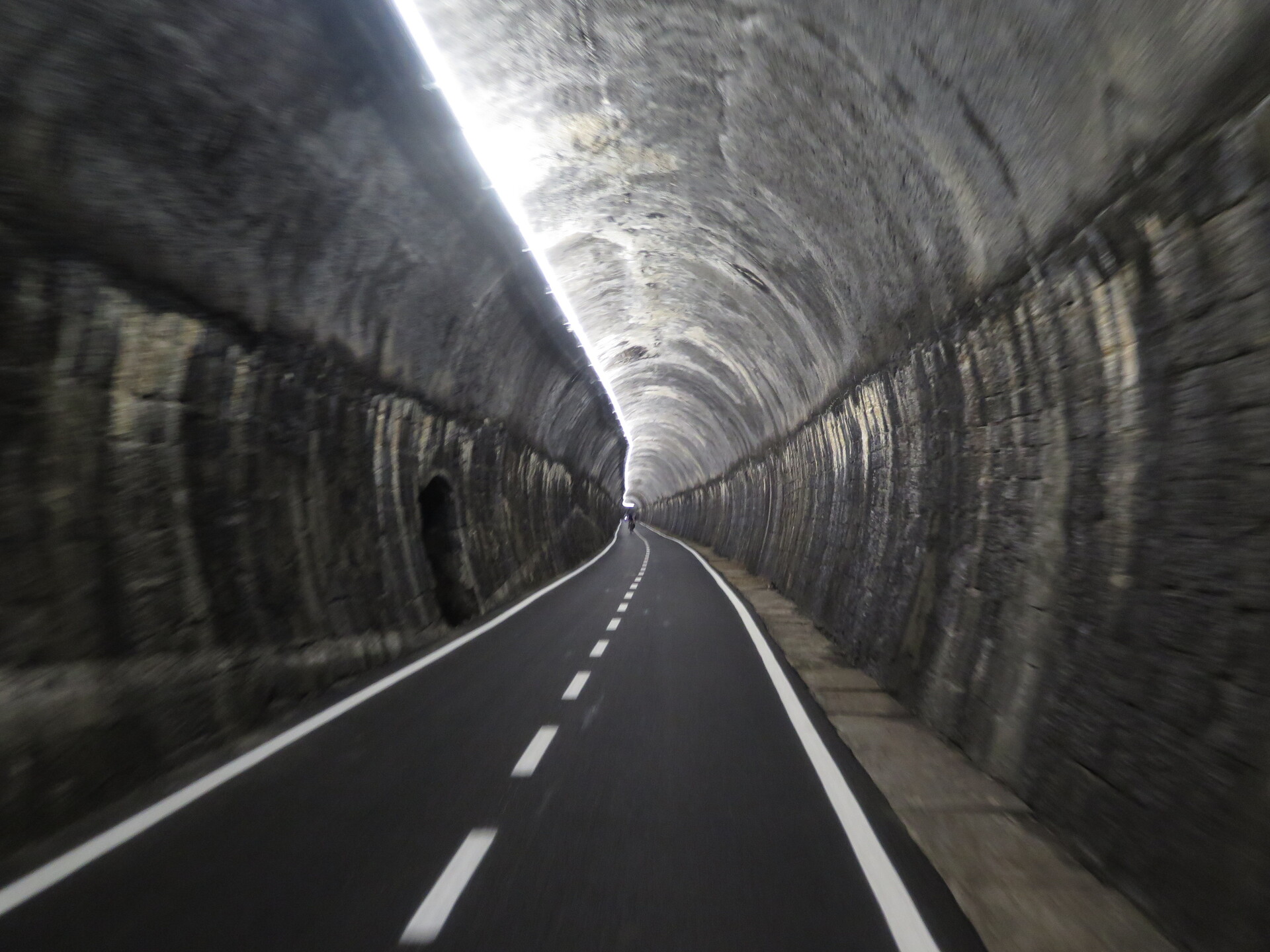
One of the cycle tunnels, third stage.
In the direction of the main tunnel, that will be done by train.
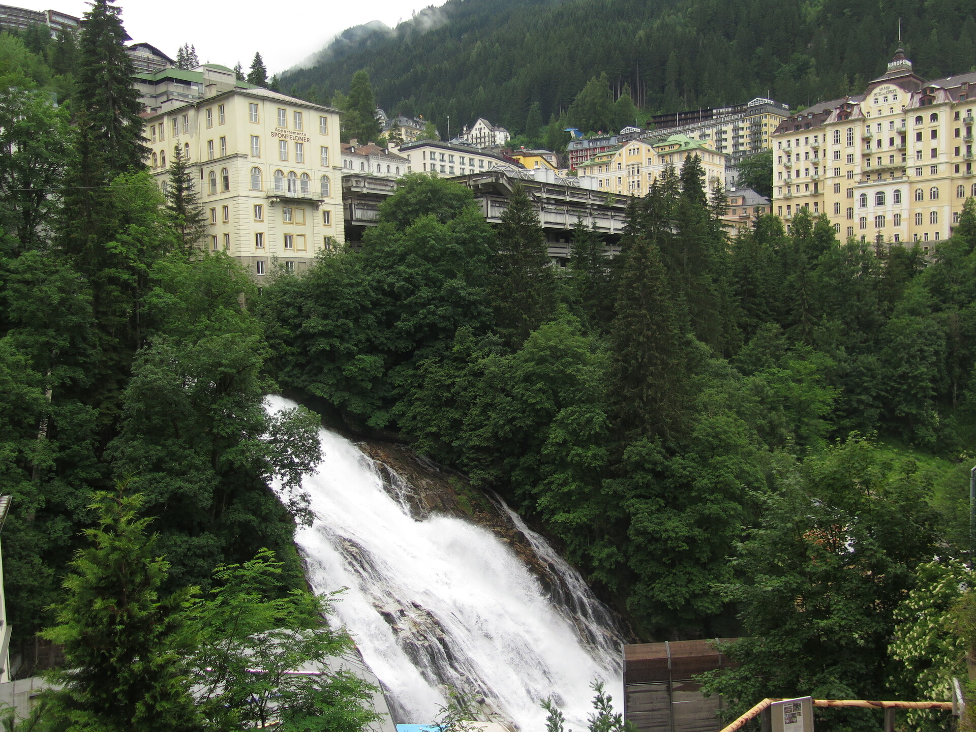
The town of Bad Gastein.
Peculiar for the waterfall ... and the climb to see it.
On the other side of the tunnel, of the Hohe Tauern.
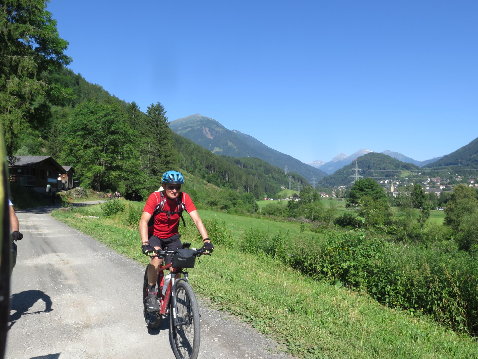
In Carinthia a wider and more descent valley in the fourth stage.
Really wide valley floor.
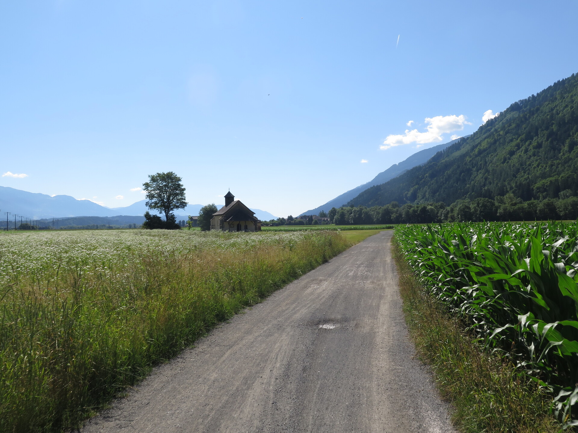
Cultivations that seem to be in Friuli.
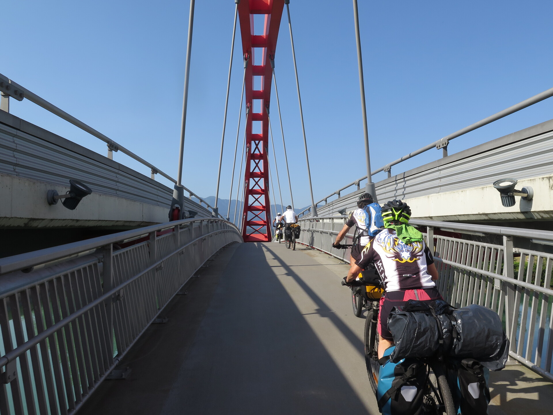
The bridge outside Villach.
Transition from the Drau River to the Gail River.
Passage to Italy.
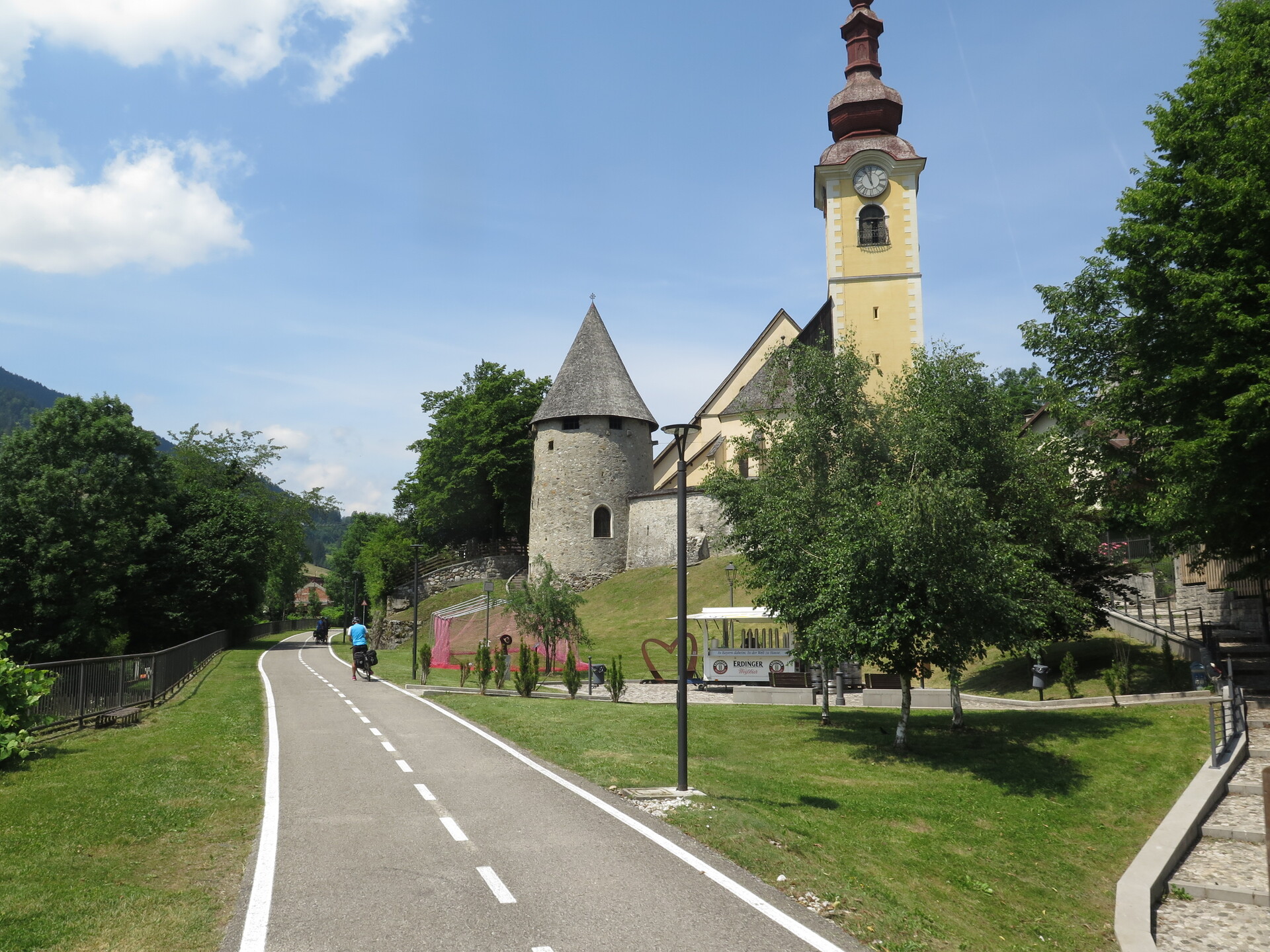
Arrival in Tarvisio.
Biking inside Canal del Ferro Valley, a wonderful part of the fifth stage.
Mix of bridges and tunnels, valleys and waterfalls.
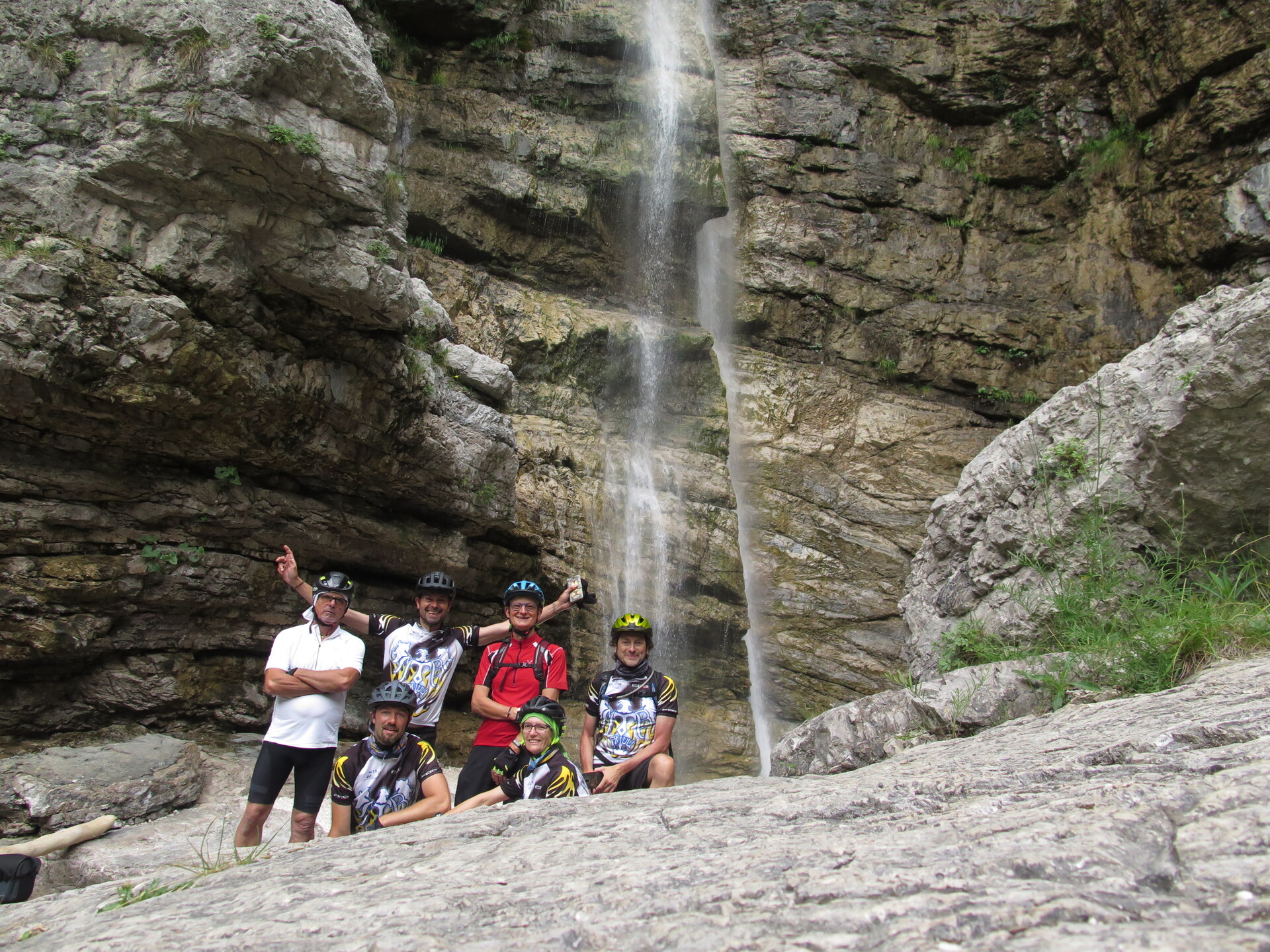
Cadramazzo waterfall.
A detour is inevitable.
Part under Gemona del Friuli.
On asphalt; it shortens and speeds up the sixth long stage towards Udine.
One of the various MTB Friuli detours, especially in the historical centres.
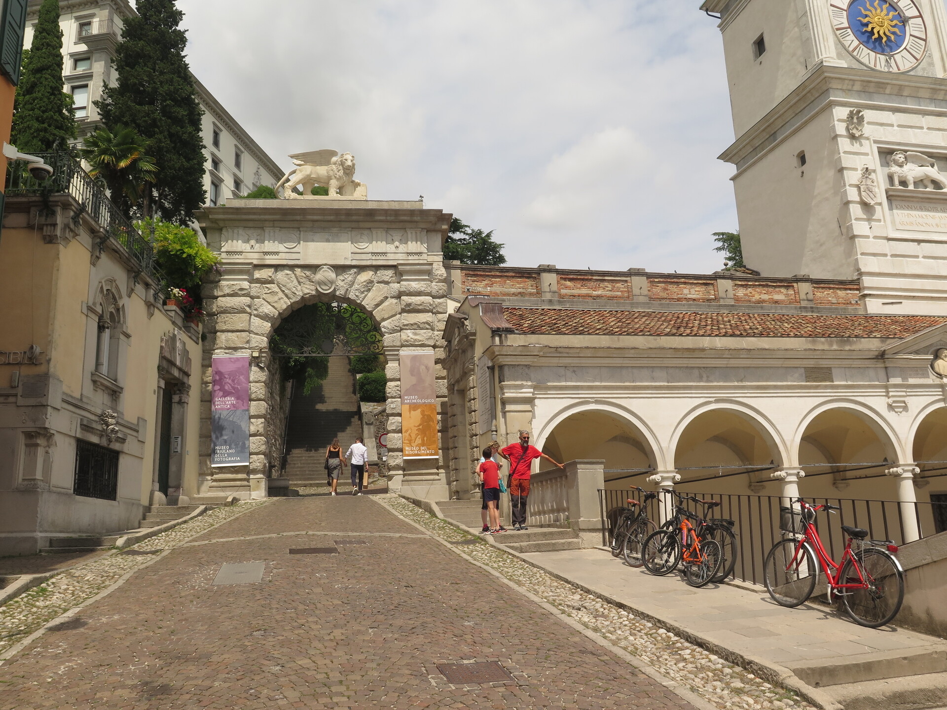
Ascent to Udine Castle.
Passage through the first Unesco city.
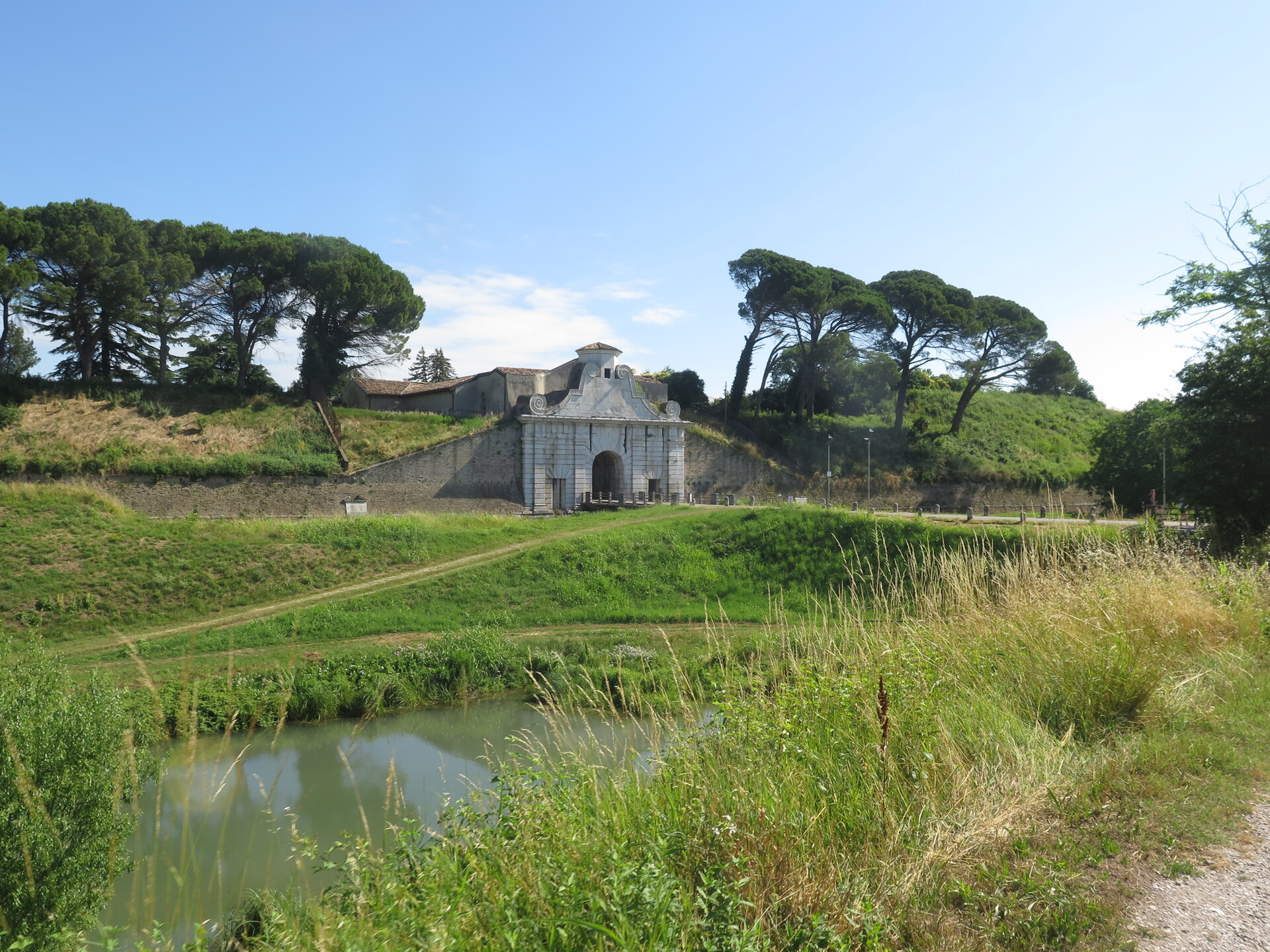
The walls of Palmanova.
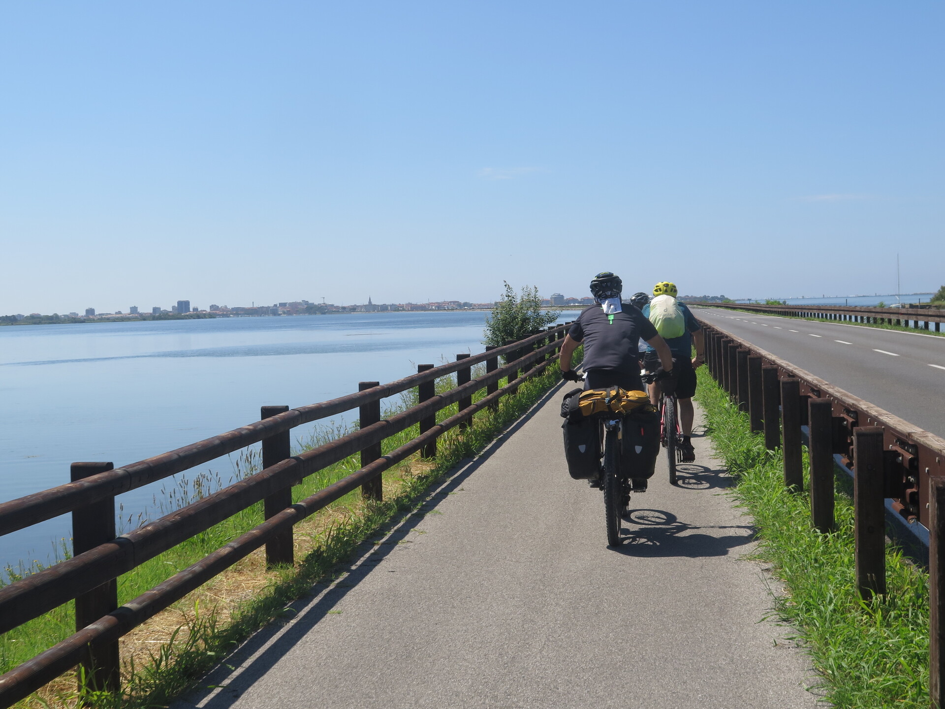
The straight line in the lagoon.
You see Grado, final destination.
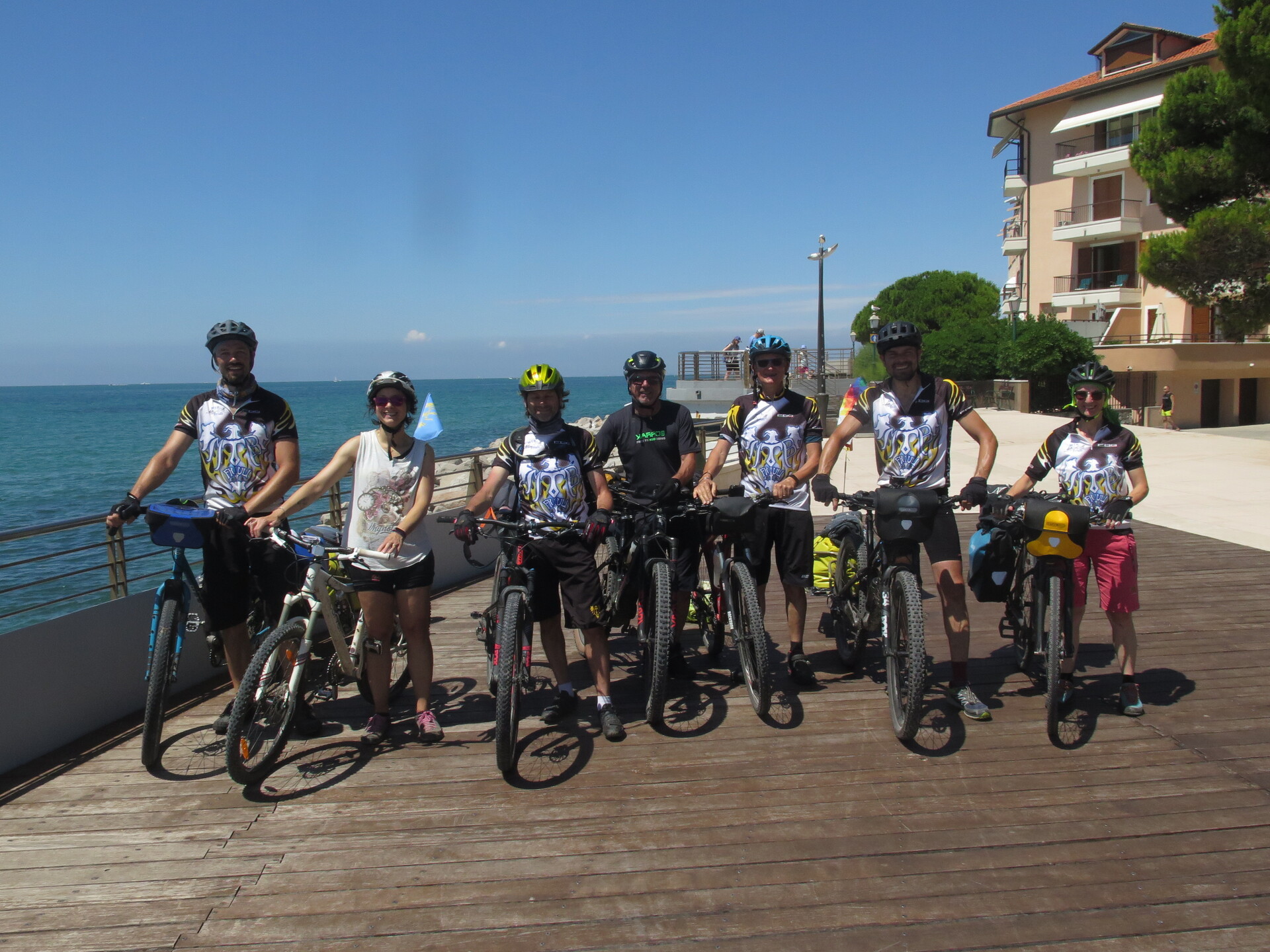
Shot at the end of Alpe Adria.
Now with the Adriatic Sea behind.
 .PDF Guide
 Parking
 Track
Track