


Paths and Travels in Friuli Venezia Giulia
Friûl Salvadi
MTB Friuli
Become a member
Paths and Travels in Friuli Venezia Giulia
July 9th - 14th, 2020
Zone: 
Physical effort:: 
Technical effort: 
 Tabacco Map: /
Path, direction, suggestion
One day we started to think about a trip in our land and a few second later the route was done. Designing a quiet journey in Friuli is easy, in a region where Nature still lives in its own way, next to man.
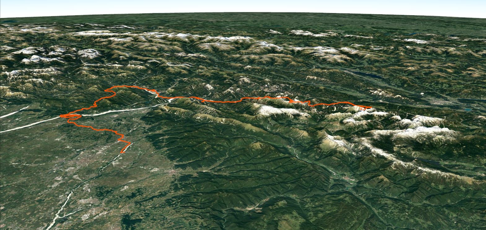
This track is just composed of six stages along the Friuli high plain, the Prealps and the Carnic Alps up to the Julian Alps. You travel mainly on dirt or secondary roads being able to look around without paying attention to the street's lane.
Where does the chosen name come from? Part of the explanation is already in the first sentence: Friuli still preserves the environments present inside, numerous and varied all across the whole area. The first translation of the Friulian word "salvadi" is "wild", which is not only related to animals but also to the style. And wild is precisely whats reborns on occasions like this journey where by moving, sleeping, living in nature, the body rediscovers its senses and the mind reopens and reorders the importances.
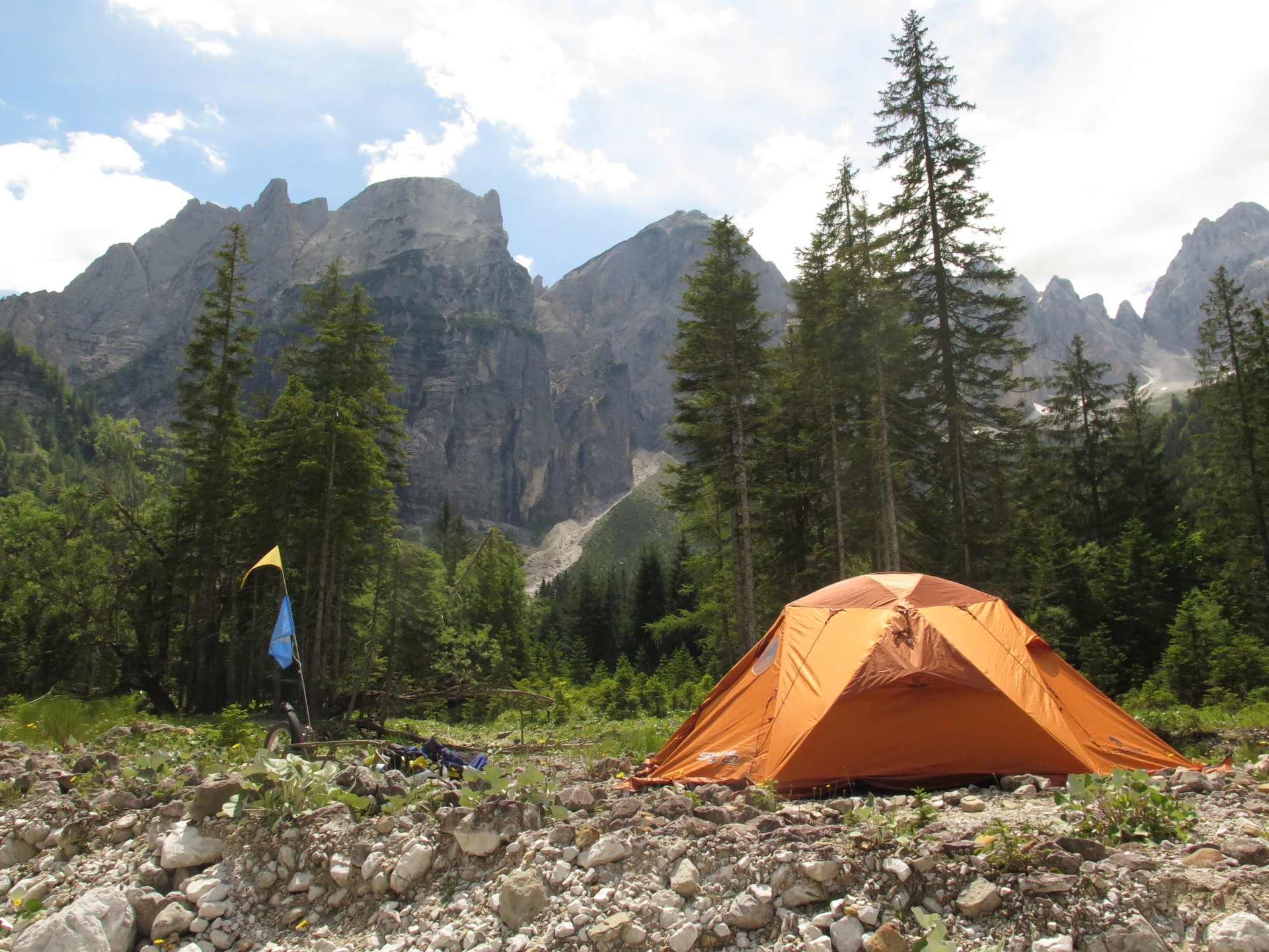
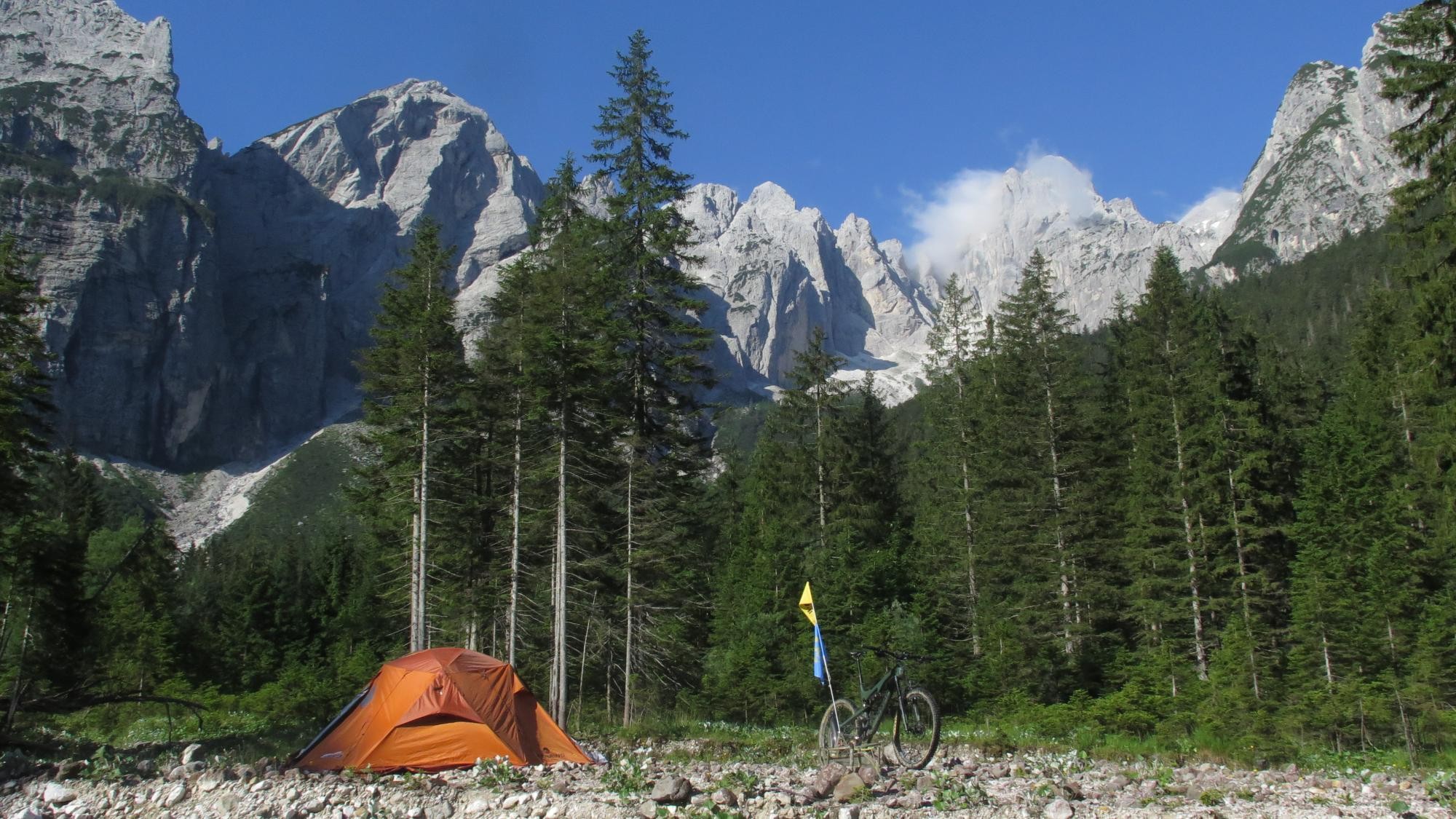
The "salvadi" spirit would imply facing the adventure by camp, moving with bike and tent. So you would not need reservations and you don't have limits on distance and altitude difference. This is how the path was designed and how the path is structured. Given the consequent weight load, on the other hand the stages are all less than 50km long, with reasonable slopes and without particularly technical sections, as far as possible.
With small changes the route can be adapted to overnight stays at structures.
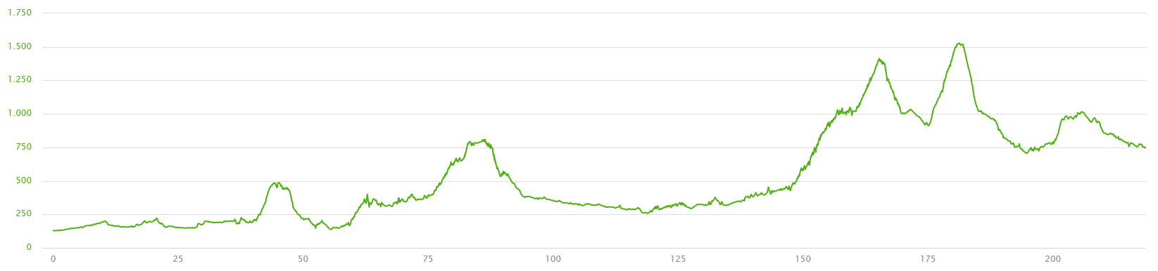
Below you can find the development of the route split into 6 stages:
| Stage | Length L (km) | Elevation gain H+ (m) |
|---|---|---|
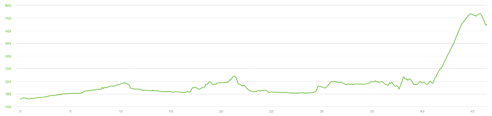
| 1st Stage: Salt – Ragogna | 46 |
600 |
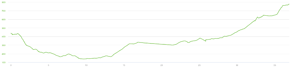
| 2nd Stage: Ragogna – Arzino Valley | 37 |
750 |
| 3rd Stage: Chiampon Saddle - Resia Valley | 46 |
300 |
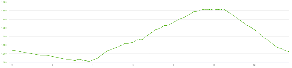
| 4th Stage: Resia Valley - Dogna Valley - Saisera Valley | 37 |
1200 |
| 5th Stage: Saisera Valley - Rio Freddo Valley | 14 |
650 |
| 6th Stage: Rio Freddo Valley - Fusine Lakes - Tarvisio | 33 |
450 |
| Totally | 213 |
3900 |
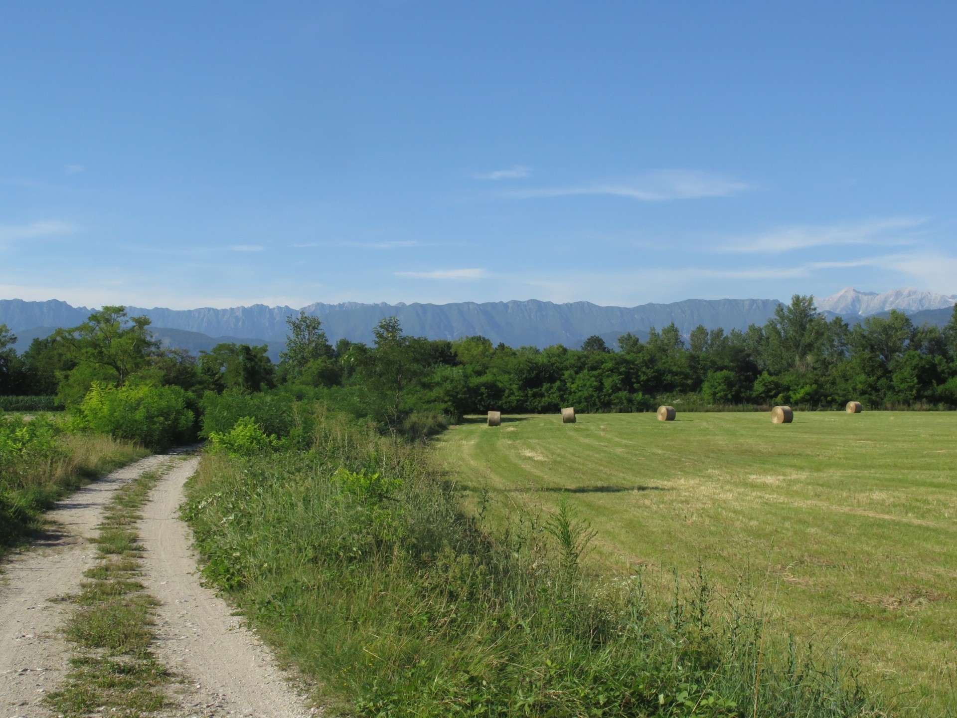
The begin is just outside of Udine city, precisely at the Torre Stream Park in the town of Salt. You cross the river to proceed on the embankment. Crossing Reana del Rojale town leads you to the Alpe Adria cycle path and to the town of Tricesimo, which is avoided by passing to the dirt road. In the countryside you can see the beautiful centers of Cassacco and Colloredo di Monte Albano and their castles. Moving practically without crossing villages, you don't have the feeling of the distances except when you arrive to San Daniele del Friuli, beyond which you bike along the Ragogna Lake. You are therefore at the same name mountain. So to be climbed from the western side, you bike around it. Stage finishes at the panoramic point over Tagliamento River, Gemona del Friuli city area and the wall of the Prealps.
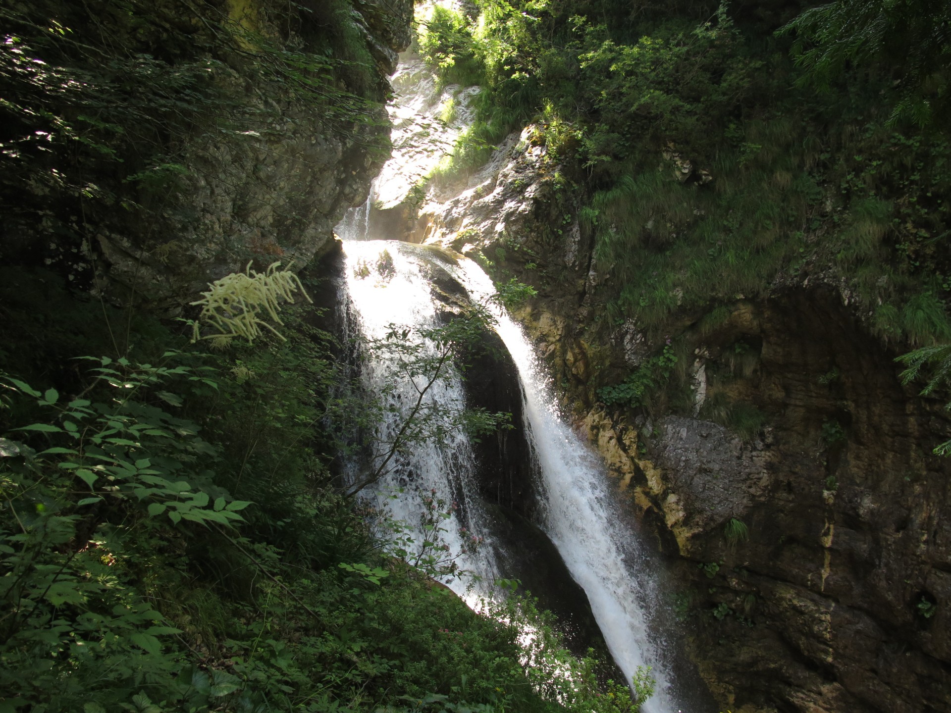
You descend so from the hill, you cross the river of the Region so to reach the valley of the Arzino torrent. After getting inside and passing the series of hairpin bends in the town of Anduins, then you are inside the real valley. You move along a road that dominates the view of the stream below. Follow the great part with the bridges over the gully and a the secondary road still beside the river. From the town of San Francesco starts a part on the state road with a view to the top of Monte Verzegnis, the reference point of the stage. Turning onto a dirt road, you will once again stay alongside the stream gorge so to reach the Arzino waterfalls. Shortly after, you reach the Chiampon Saddle and the amazing source of the stream.
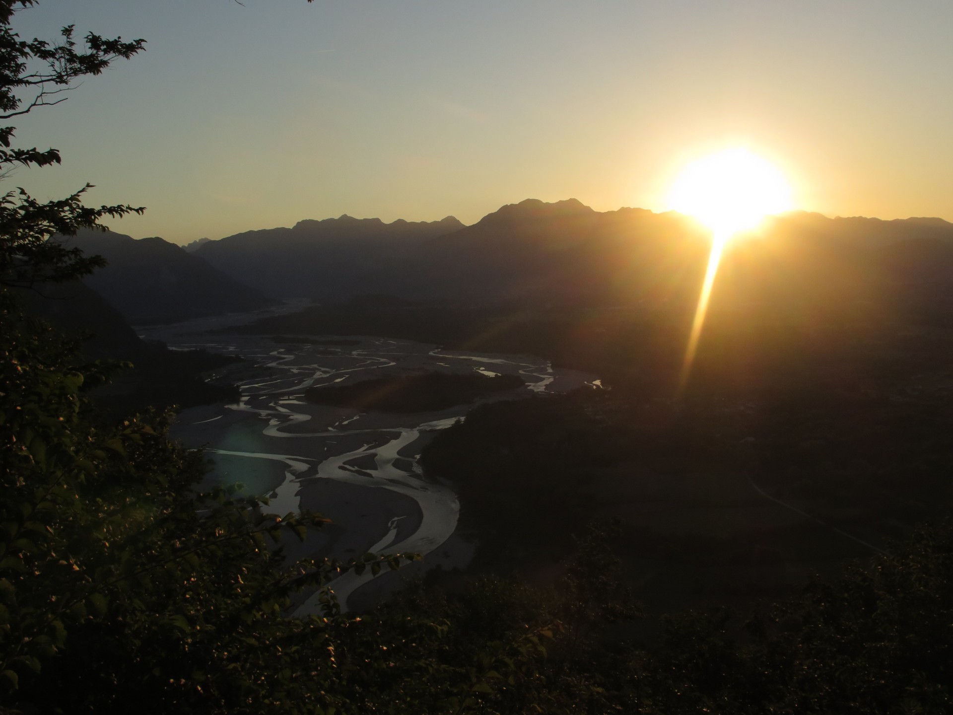
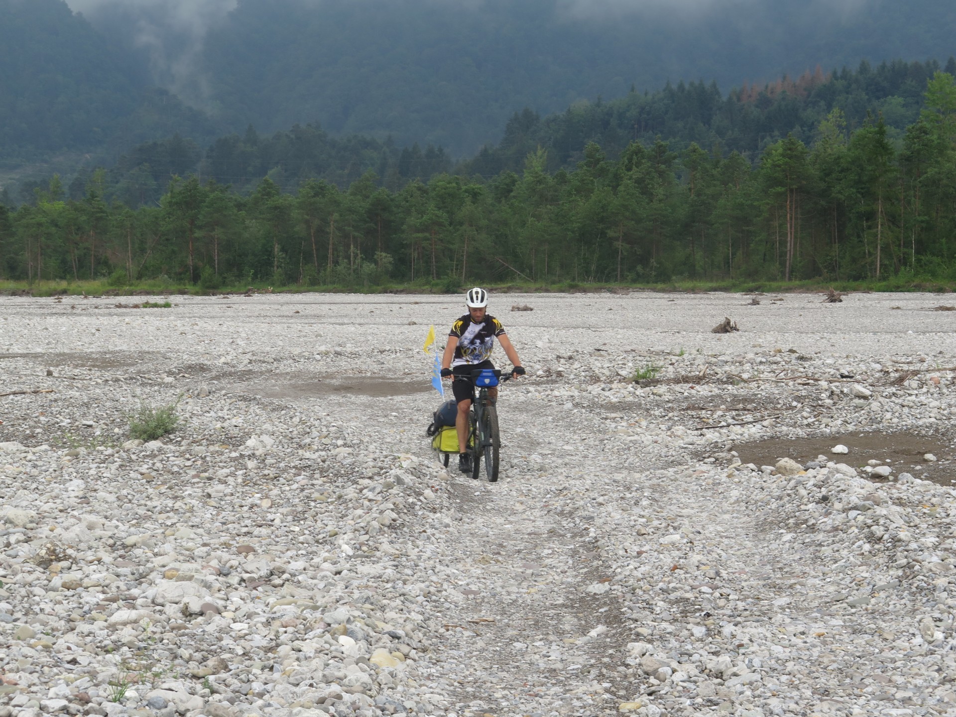
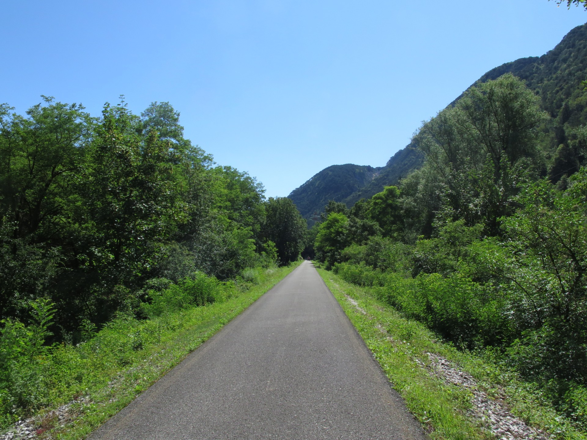
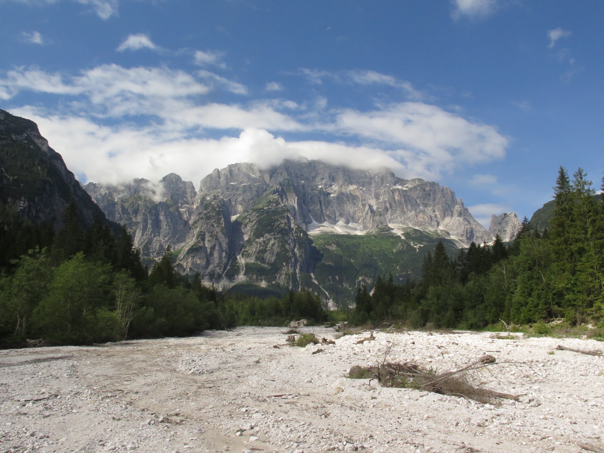
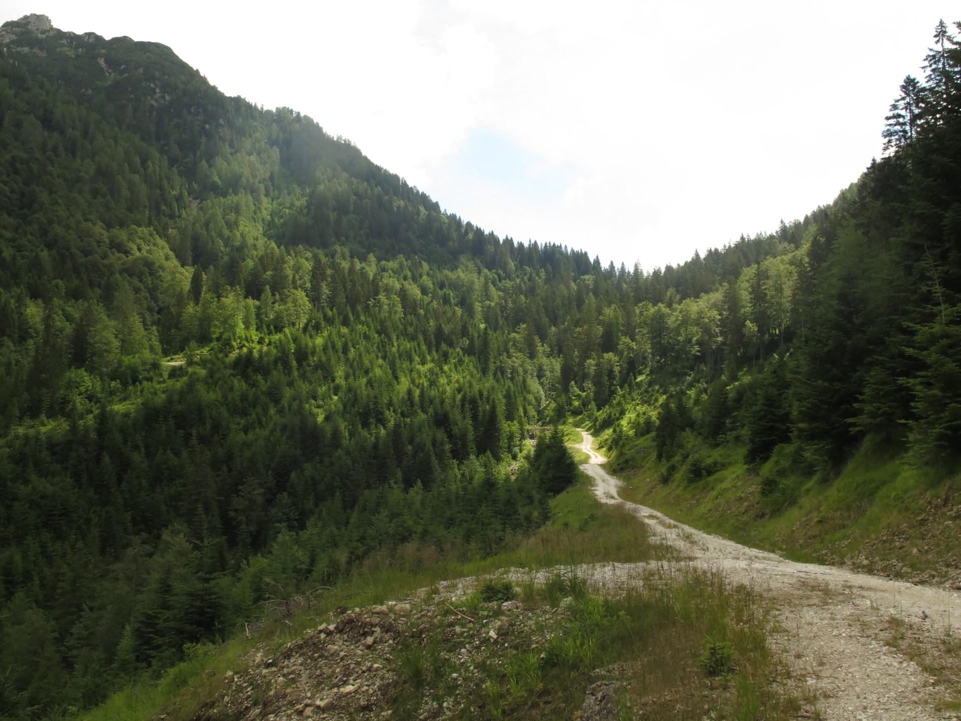
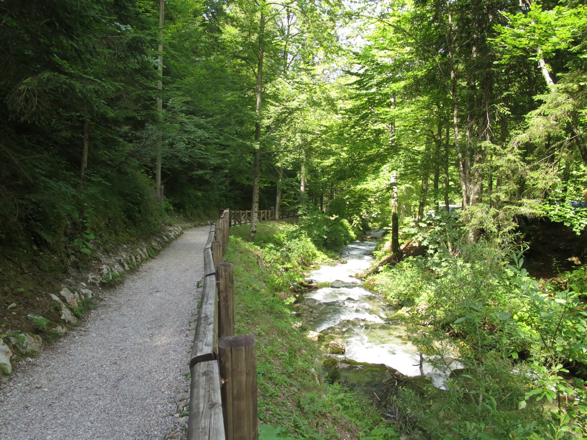
From Chiampon Saddle you go down to the valley floor inside Carnia. Beyond Preone a ford takes you once again on the Tagliamento River. You reach so the Degano Stream and you cross the small town of Villa Santina. A beautiful cycle path quickly leads to the city of Tolmezzo, of which you cross the center to proceed towards the Julian Alps. Always avoiding large roads, you reach the Alpe Adria bike path that drives you to Resiutta, where you leave it to enter Resia Valley by pointing to the camping area of Povici di Sopra.
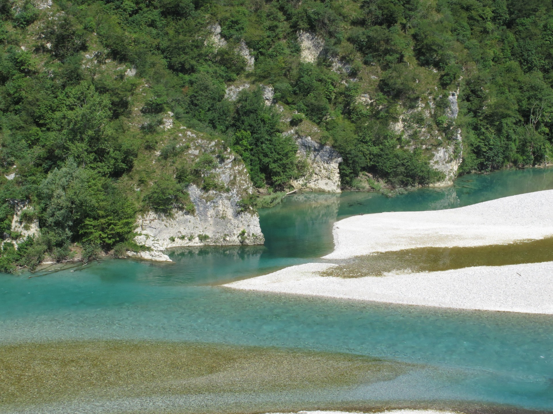
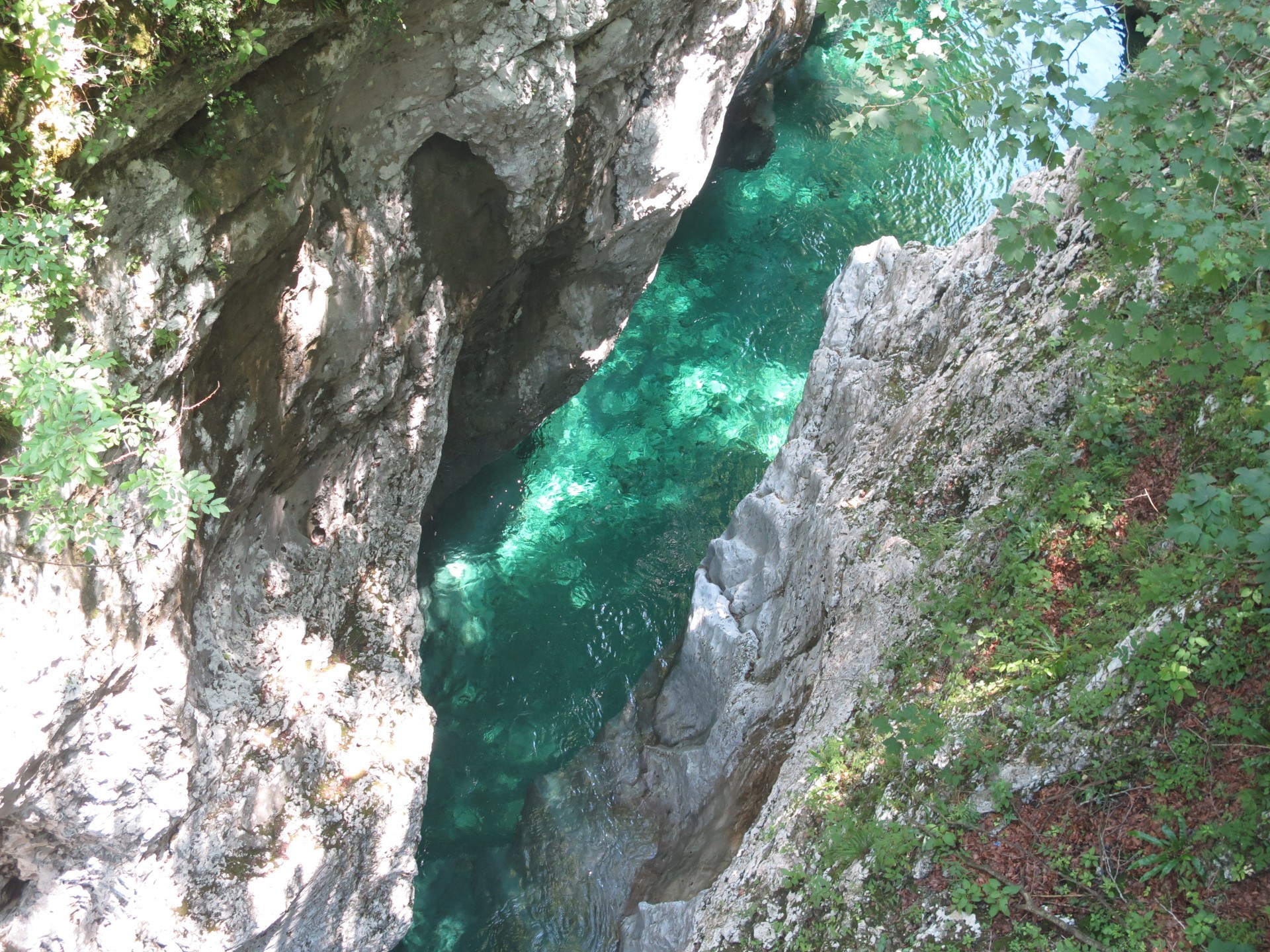
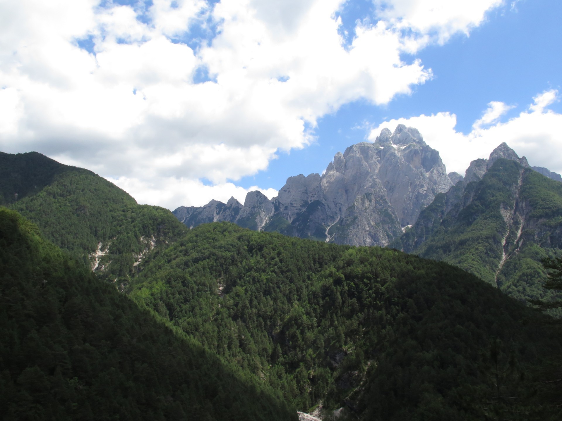
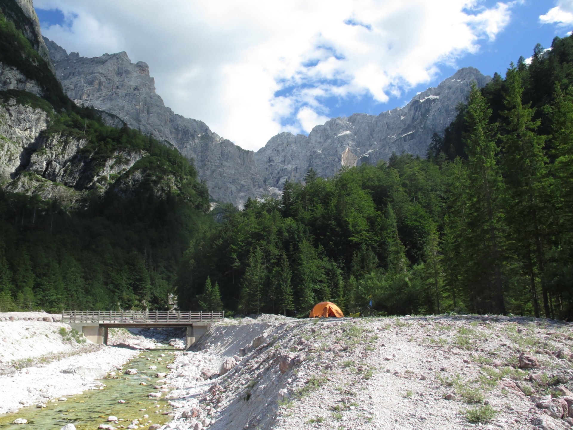
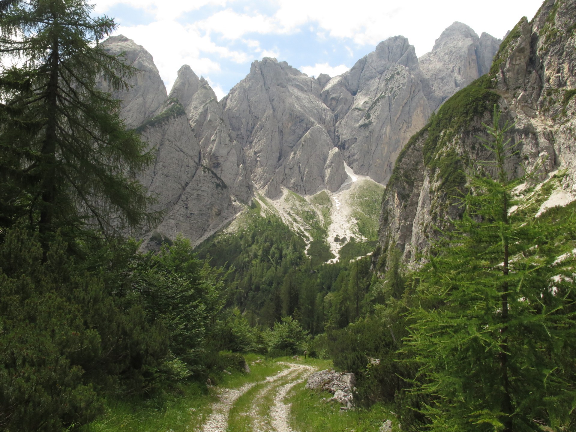
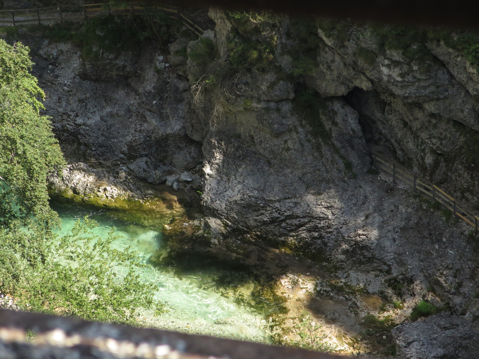
If you could have taken a rest at last stage, the fourth stage allows you to consume what you have saved. The beginning is quiet along the beautiful Alpe Adria cycleway and its most spectacular stretch with sequences of tunnels, bridges and waterfalls. Anyway, once you reach the town of Dogna, you abandon the cycle path to start climbing the Dogna Valley. A comfortable paved road with a moderate and uniform slope consists of the main effort of the day, rewarded by the views to the Jôfs mounts group. From Sompdogna Saddle a gravel road crosses the slope. You pass beside Grego Shelter and then you have the descend into Saisera Valley. After descending on the path, you continue along a dirt track in the riverbed down to the Mount Jôf Fuart.
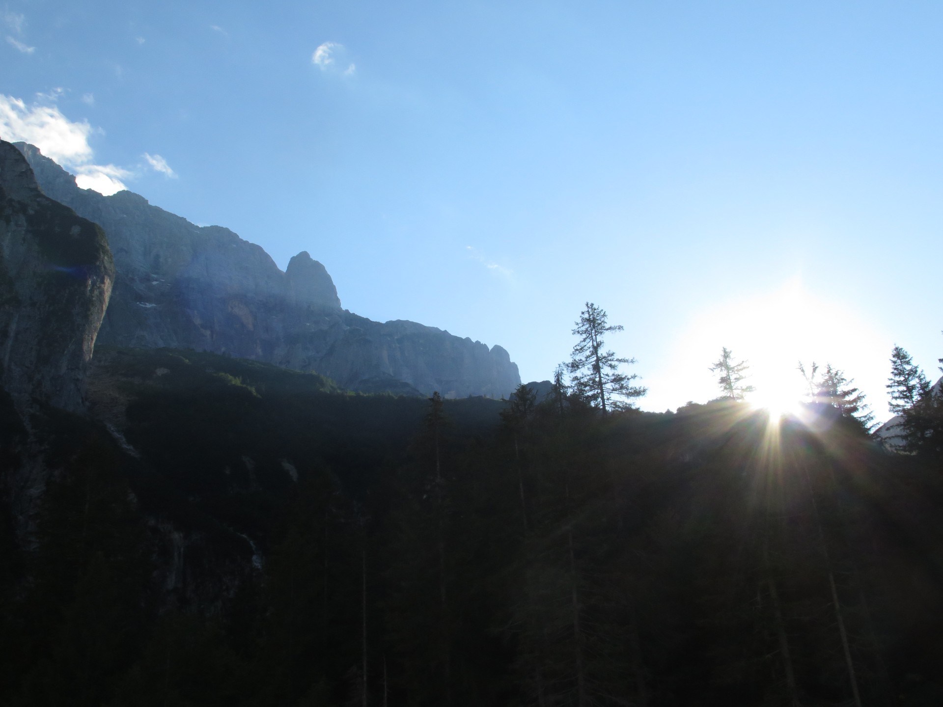
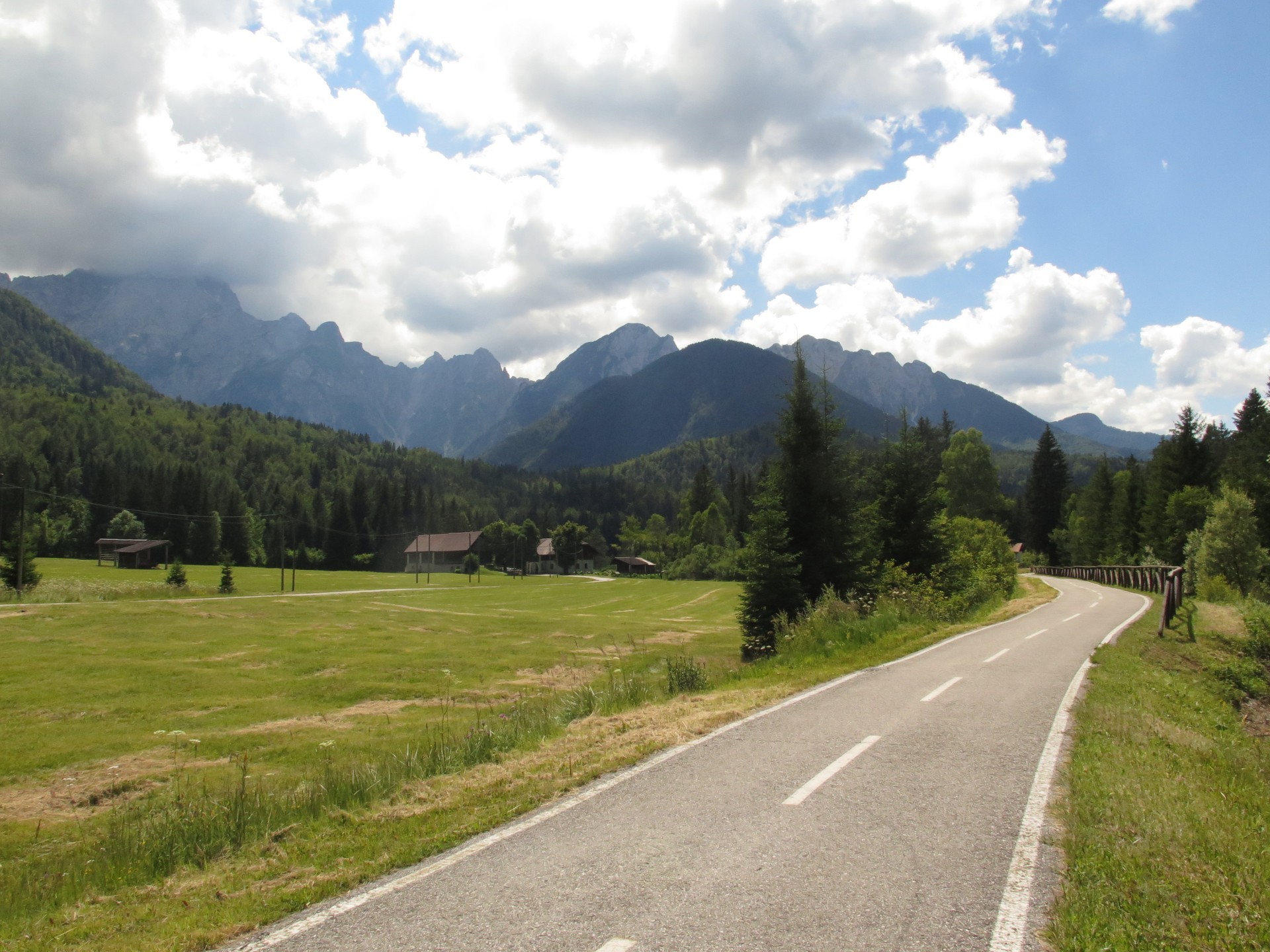
The shortest stage of the journey, but not the easiest. You go down towards the valley floor between forests and rough stretches in the riverbed. You start ascent onto the dirt road towards the Pellarini Shelter. Initially moderate, the dirt road has ramps that quickly take altitude. Arriving at the crossroads, you will turn towards the Prasnig Saddle. The 180-deg turns end but the climb does not. Truly steep sections lead to the ridge, over that effort decreases. The last series of curves to then descend into the Rio Freddo Valley. Peaks' slopes on the front are like an arch of walls of the Julian Alps. They attracts the eye during the descent and throughout the evening.
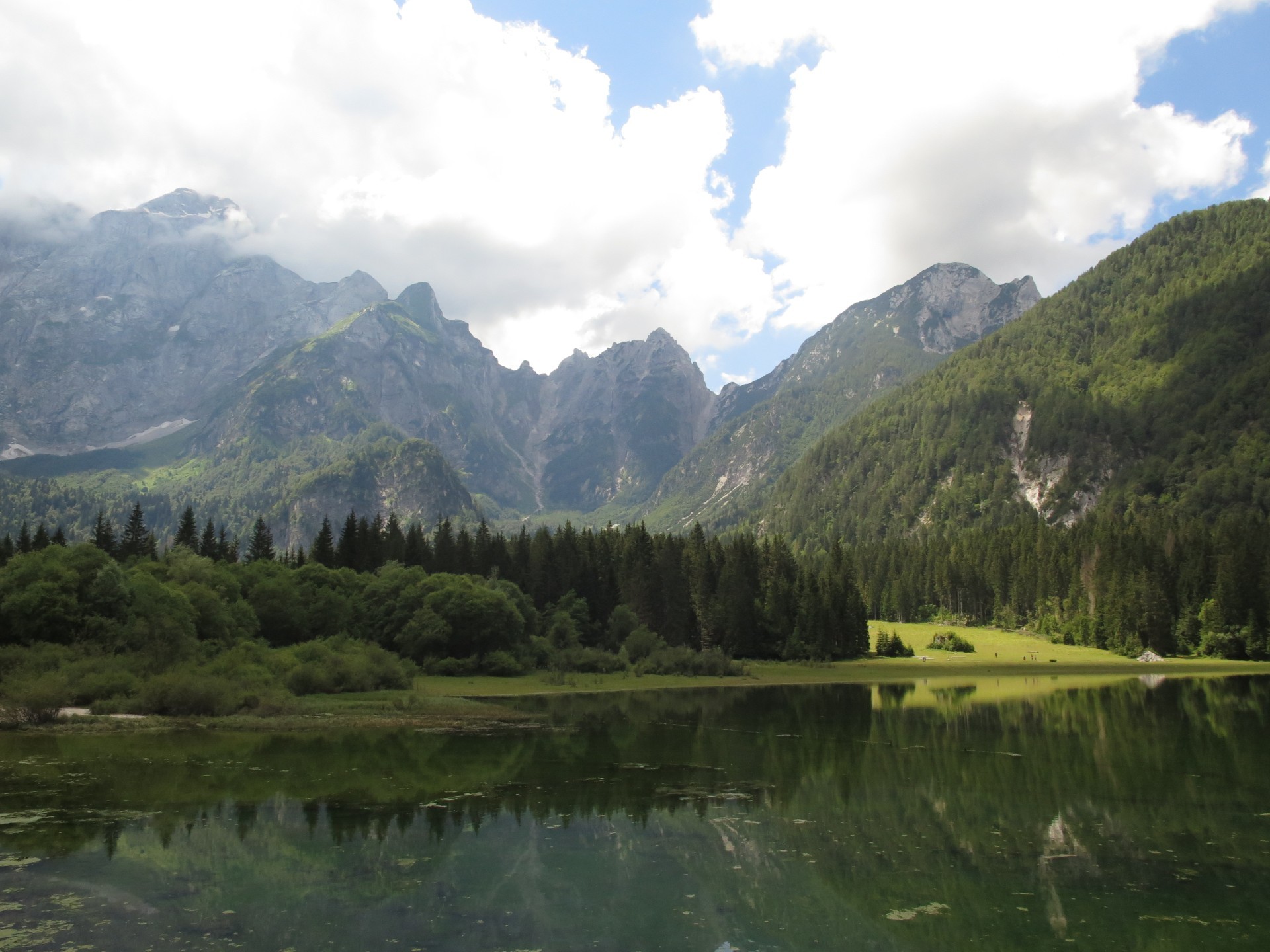
The ending can not be less due to what you passed so far. Descend into the Rio Freddo Valley so to continue on the state road above the Slizza Stream. The torrent satisfys the view downhill but, above all, on its suspension bridge in Tarvisio. From there the cycle path leads to the town of Fusine. You leave it to go to the dirt road which will bring you up and pop out over Fusine Lake. Path moves on upward to improve, as far as possible, the breathtaking view of the Ponza, Veunza and Mangart mountains. You descend after to the two lakes and then to the main valley near the pass with Austria. Always on the cycle path you return to Tarvisio town and the Boscoverde train station.
 , Technical Effort
, Technical Effort 
 , Technical Effort
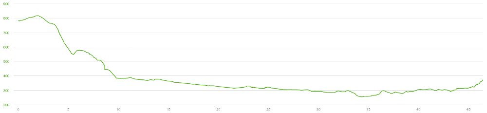
 , Technical Effort
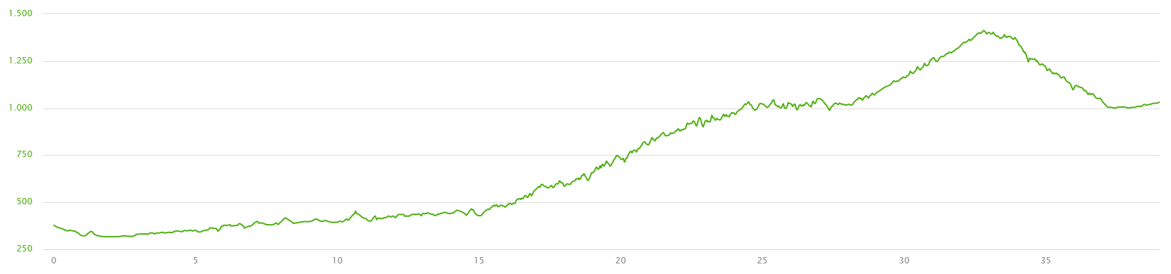
, Technical Effort 
, Technical Effort 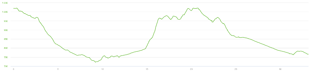
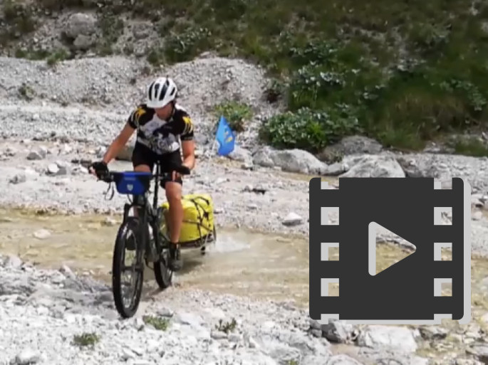
Track's picture and video
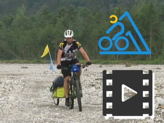
The splendor of Friuli.
60" of glipmses of our nature.
 .PDF Guide
 Parking
 Track
Track