


Paths and Travels in Friuli Venezia Giulia
Microcosm of Friuli
MTB Friuli
Become a member
Paths and Travels in Friuli Venezia Giulia
14 - 19 Giu 2021
Zone: 
Physical effort:: 
Technical effort: 
 Tabacco Map: 41, 26, 27, 13, 28

Path, direction, suggestion
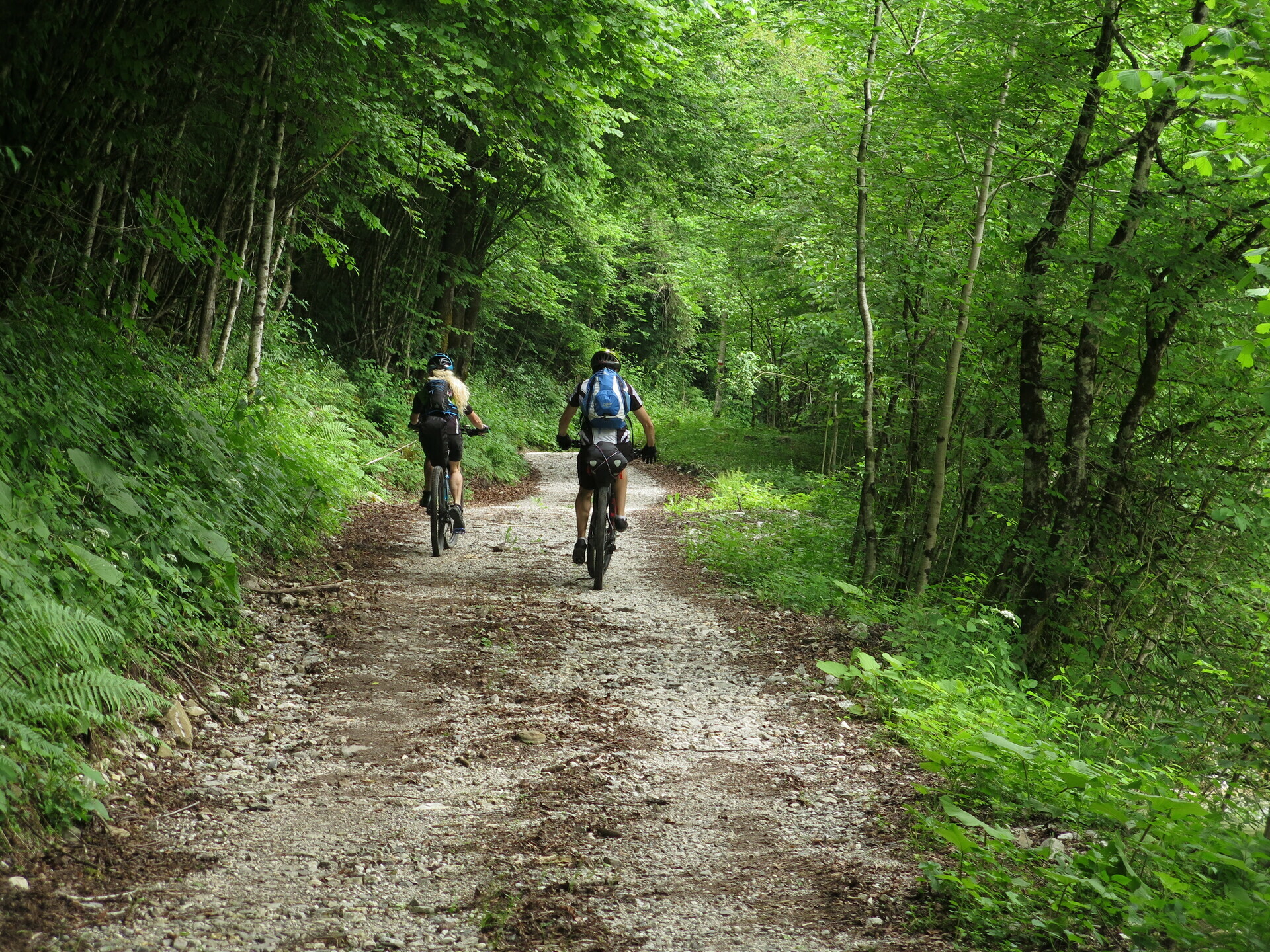
Biking is not only the Sunday bike ride, it is an opportunity to explore nature delicately, to visit historical places without haste, to embark on adventures with friends as same as to meet new people, all to create and to live unforgettable experiences.
Last year MTB Friuli ventured into an extraordinary adventure, the Friûl Salvadi. With the Microcosm route we present an enterprise with wilderness, with historical points and, above all, with the difference in accommodation. The overnight stay in structures lets you travel with the minimum necessary and not with the equipment of a real expedition.
Where does the name come from? There was the same question also for for the trip Friûl Salvadi!
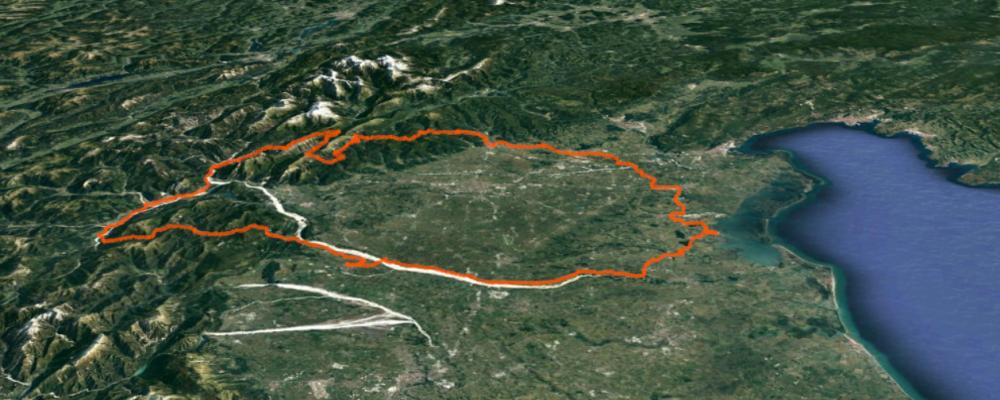
The Microcosm track runs counterclockwise around the perimeter of Friuli, thus exploring many of its numerous unique environments described below. But there's something more. For the most part without even passing through towns, carrying out this journey establishes a unique relationship between the participants and that extends to the people you meet, who cannot resist your smiles: we build a microcosm.
The arrivals of the stages are always at the facilities. Their style changes a lot during the trip; the condition common to all is the spirit of welcome together with the context that surrounds them.
The fact of being able to travel without heavy loads allows you to cover good distances and elevation gains in the day. This considering an estimated 6 hours in the saddle per stage, split by many breaks to visit points of interest or, simply, due to a rest.
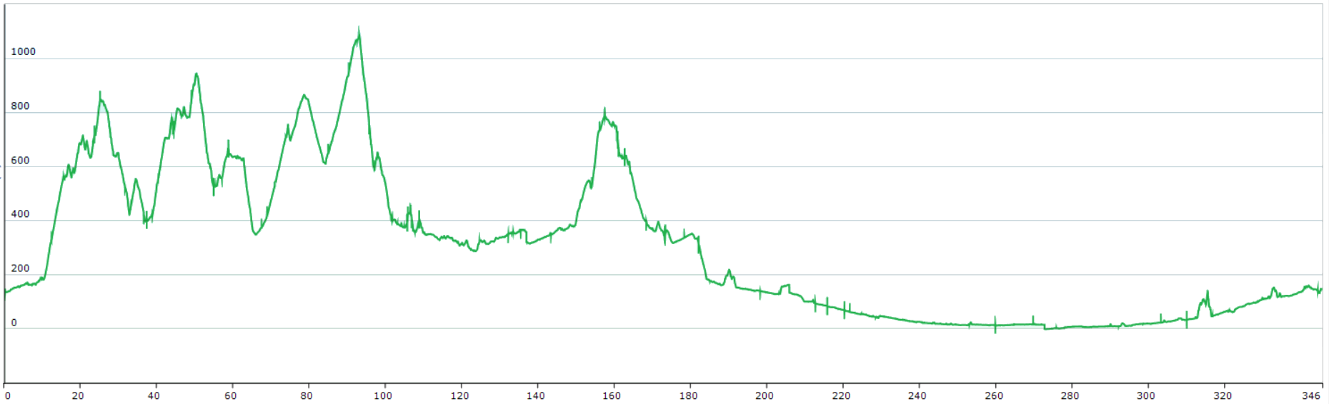
Below is the development of the path consisting of 6 stages:
| Stage | Length L (km) | Elevation uphill D + (m) |
|---|---|---|
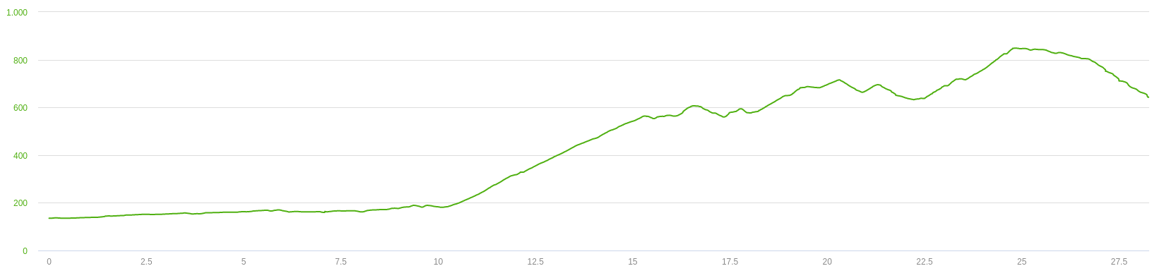
| Day 1: Cividale del Friuli - Loc. La Farcadice | 29 |
950 |
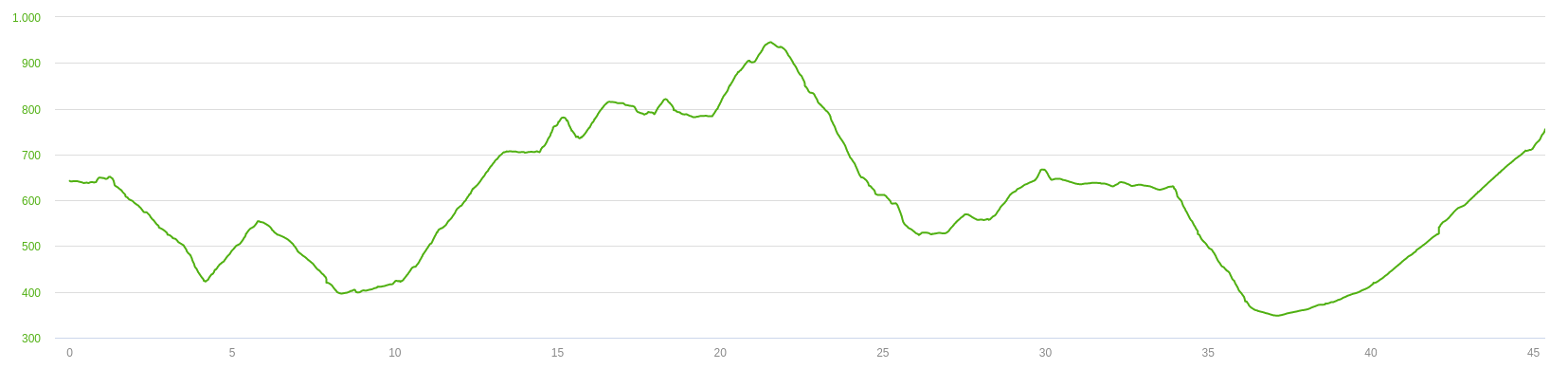
| Day 2: Loc. La Farcadice - Alta Val del Torre | 46 |
1450 |
| Day 3: Alta Val del Torre - Tolmezzo | 63 |
1050 |
| Day 4: Tolmezzo - Spilimbergo | 69 |
800 |
| Day 5: Spilimbergo - Marano Lagunare | 67 |
100 |
| Day 6: Marano Lagunare - Cividale del Friuli | 73 |
450 |
| Total | 346 |
4870 |
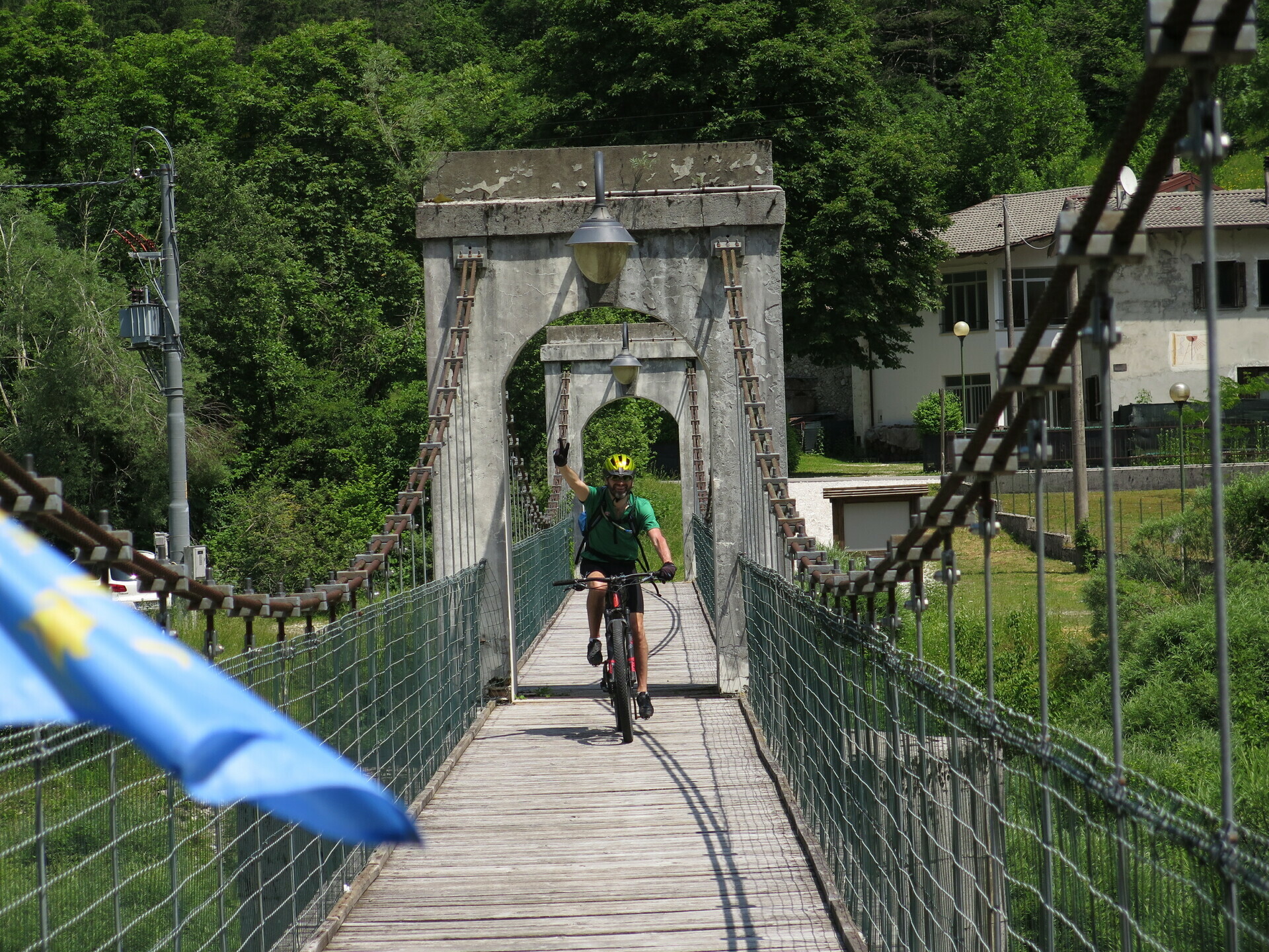
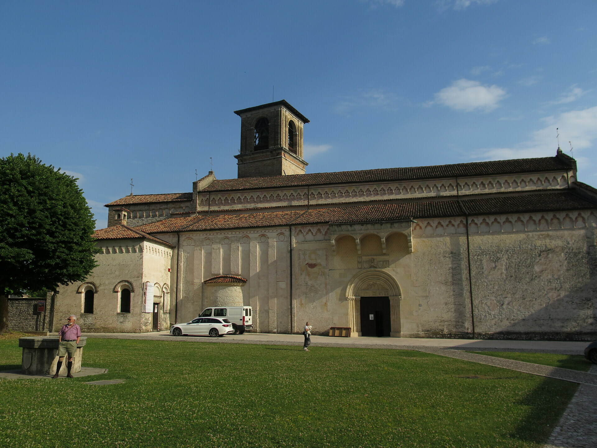
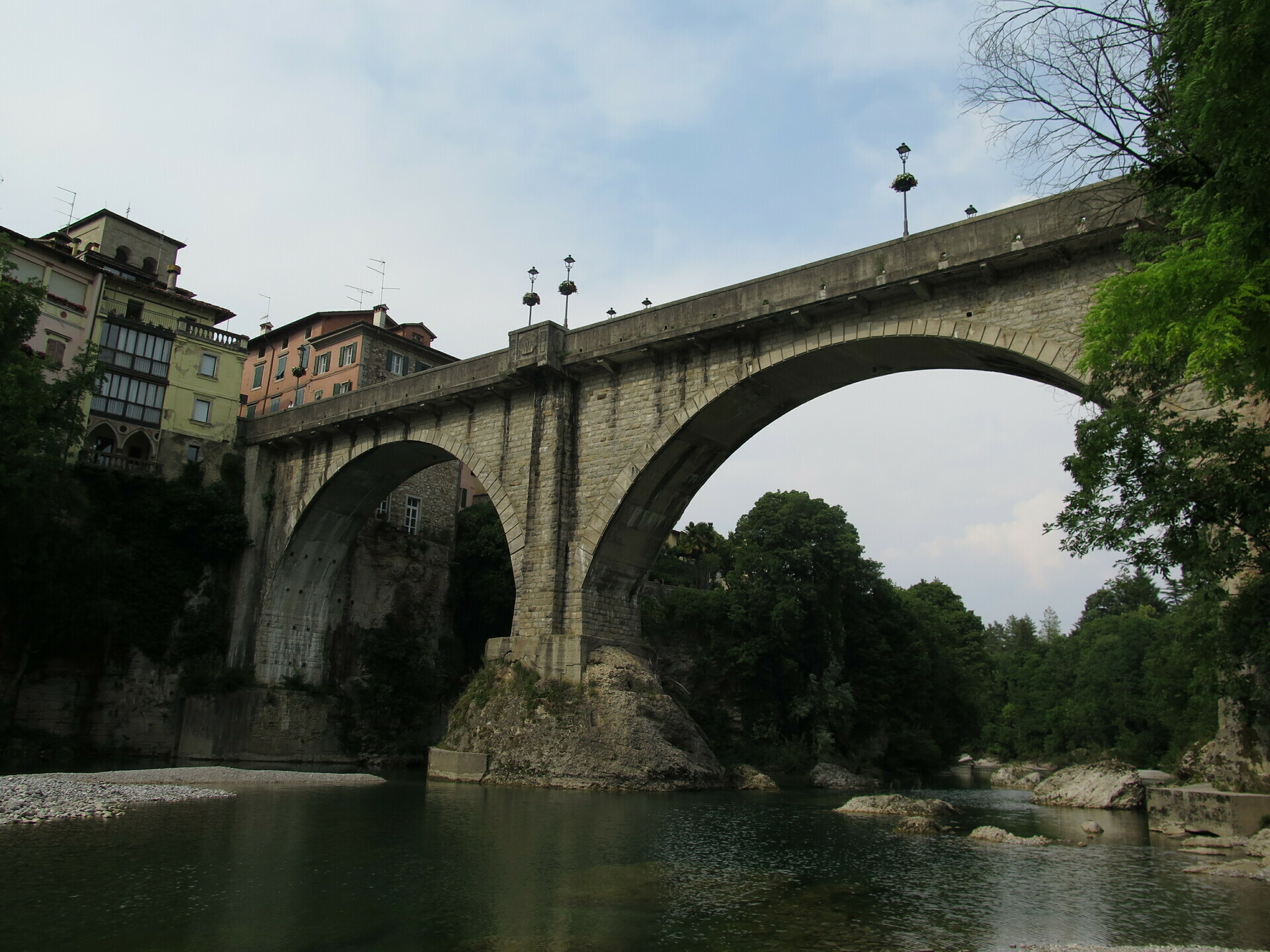
The first stage is planned for half a day, from the railway station's car park of the Cividale del Friuli you immediately leave the city. A warm-up in the countryside next to the Natisone River makes us enter the valley and reach the mountains. A mixture of climbs and descents between dirt and asphalt brings us to La Farcadice with accommodation in a tent at the Agriturismo Zaro.
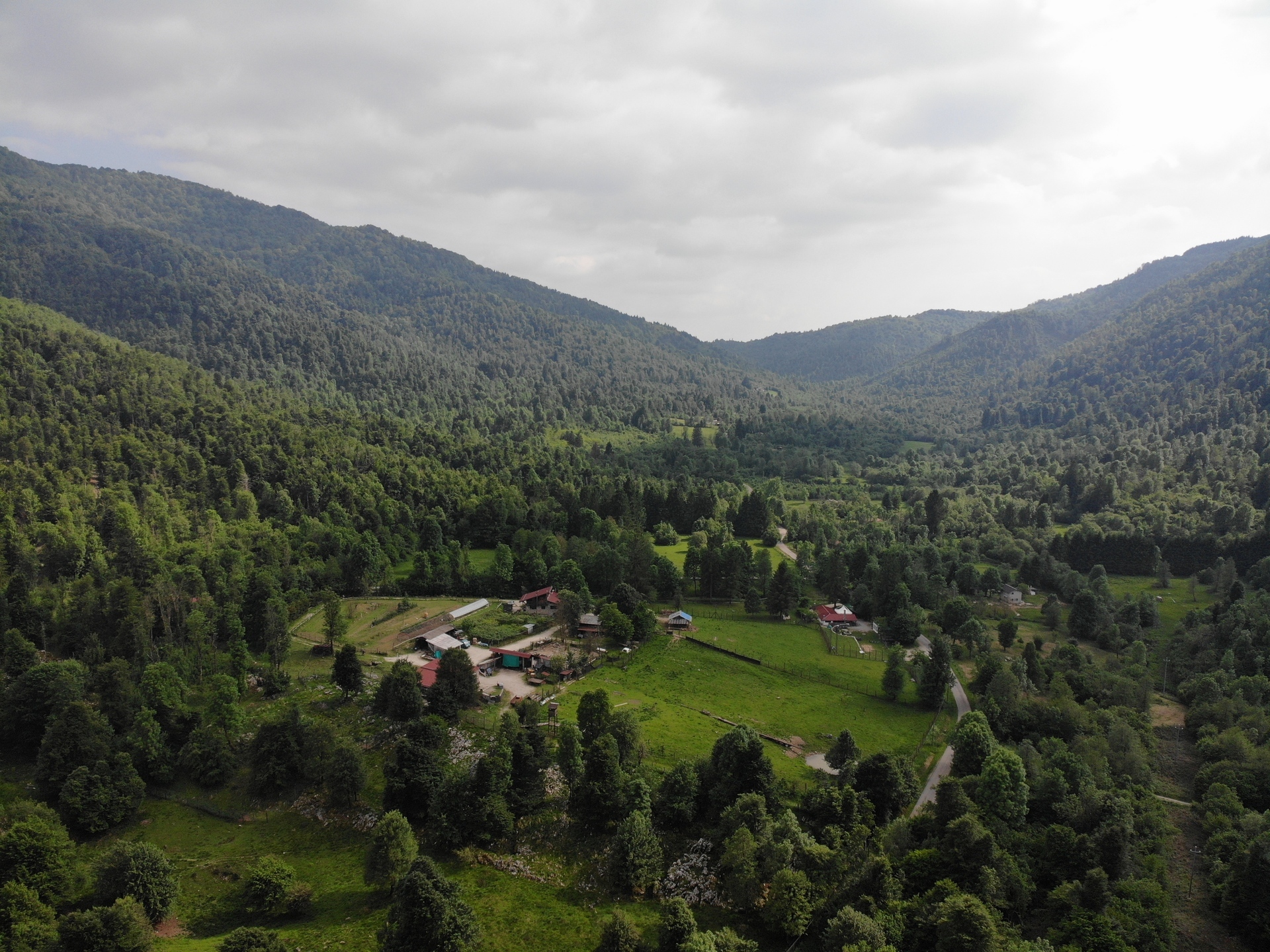
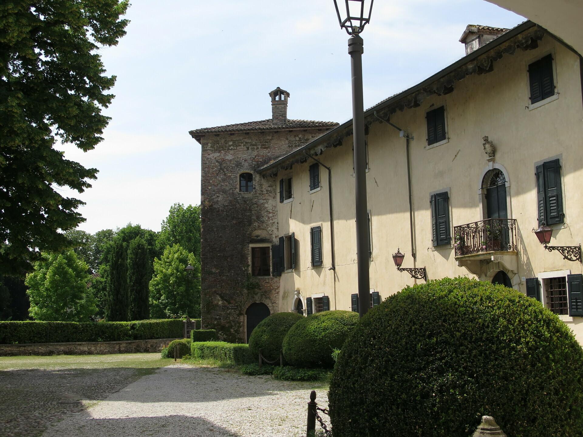
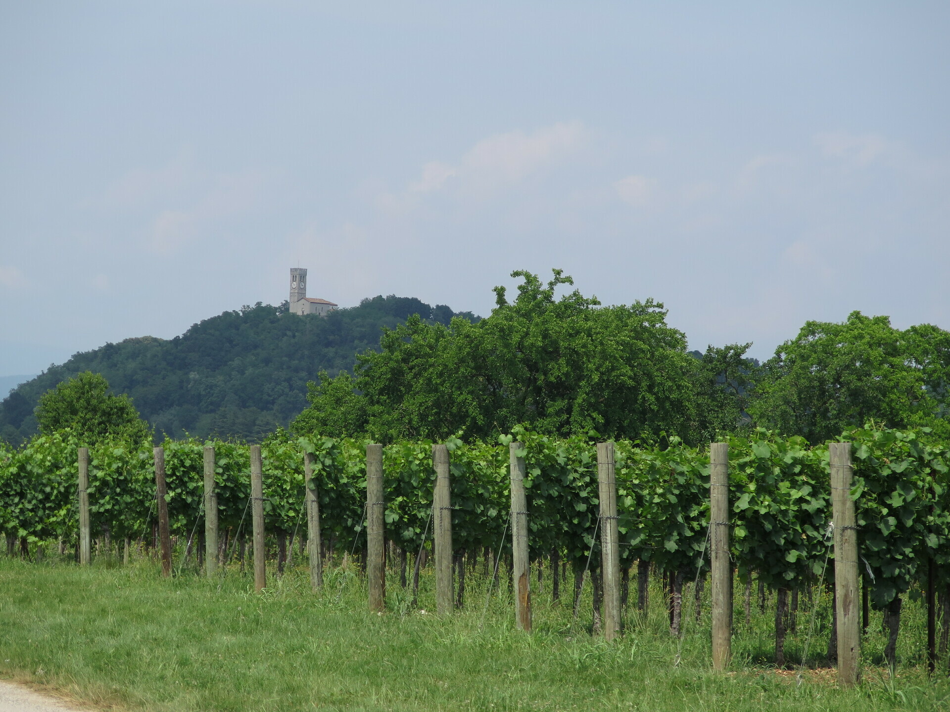
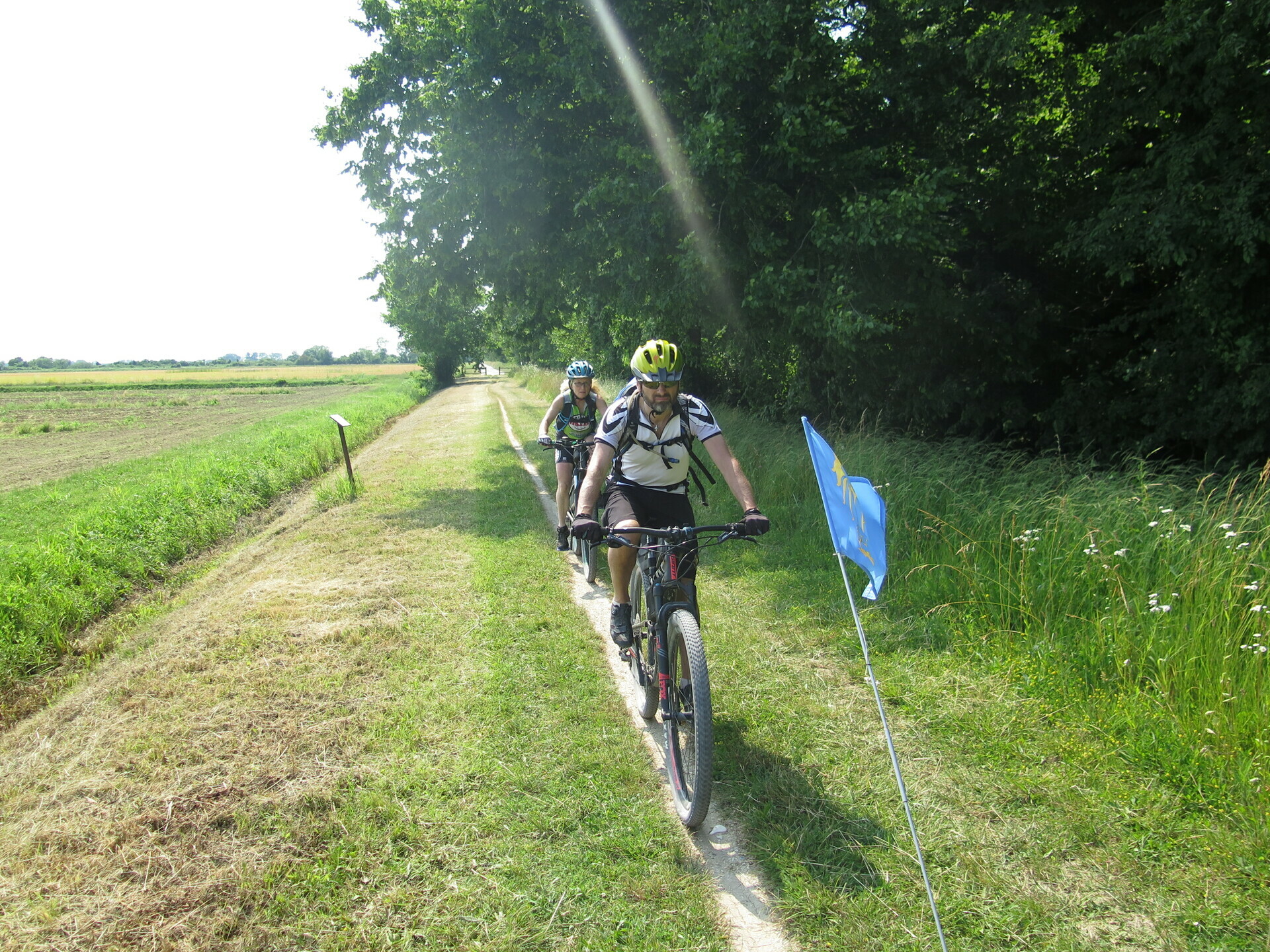
Then begins the most demanding stage of Microcosmo: both physically seen the crossing of different valleys, and technically given the quality of the stretch of road near the Rio Bianco. From the Prealps above Cividale, you skirt the Montemaggiore group to the south to descend into the Torrente Torre Valley. There you go up along the main road, enjoying the views over the gully, to reach the accommodation of the chalets with the glass ceiling La AleGra.
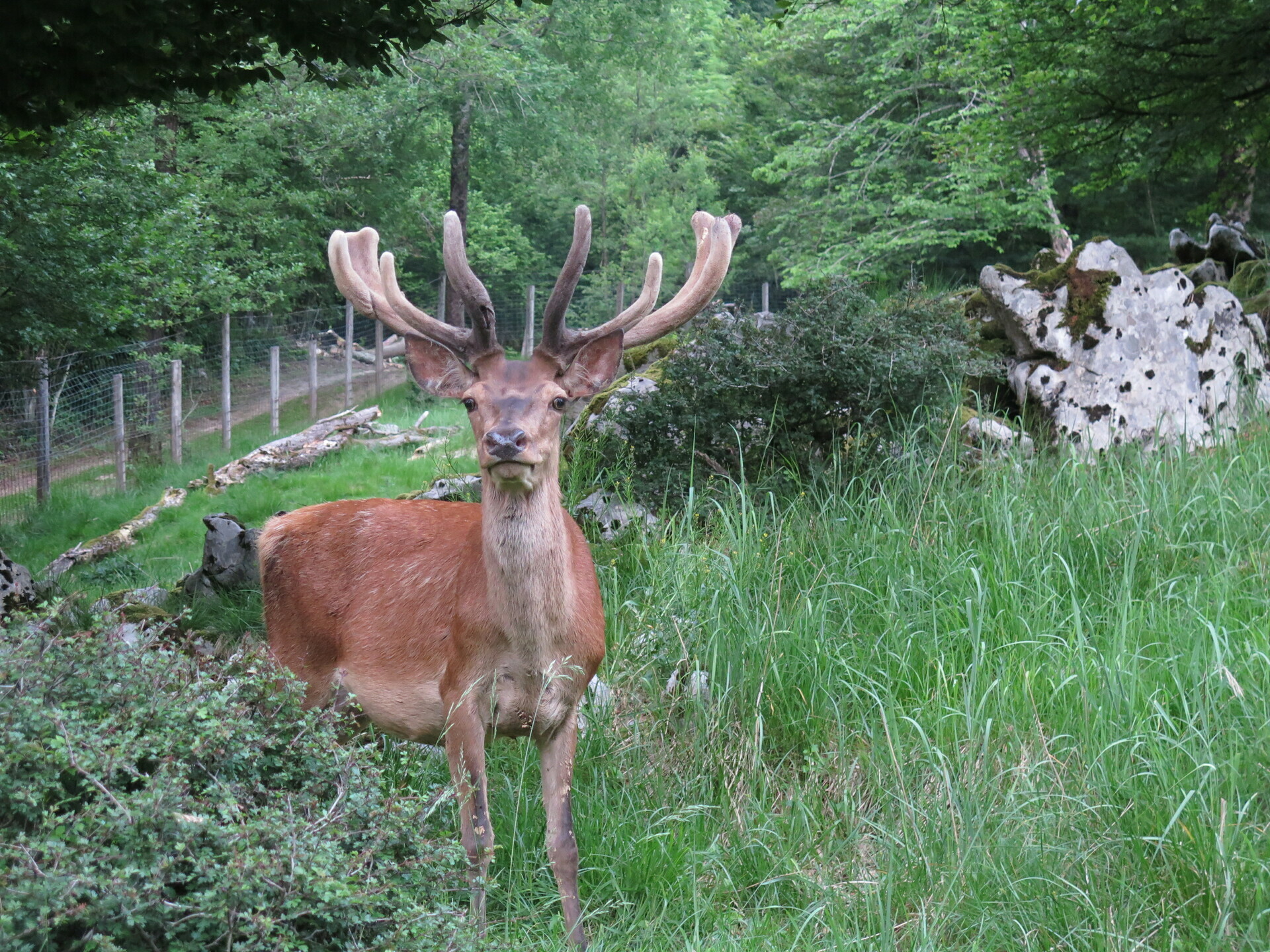
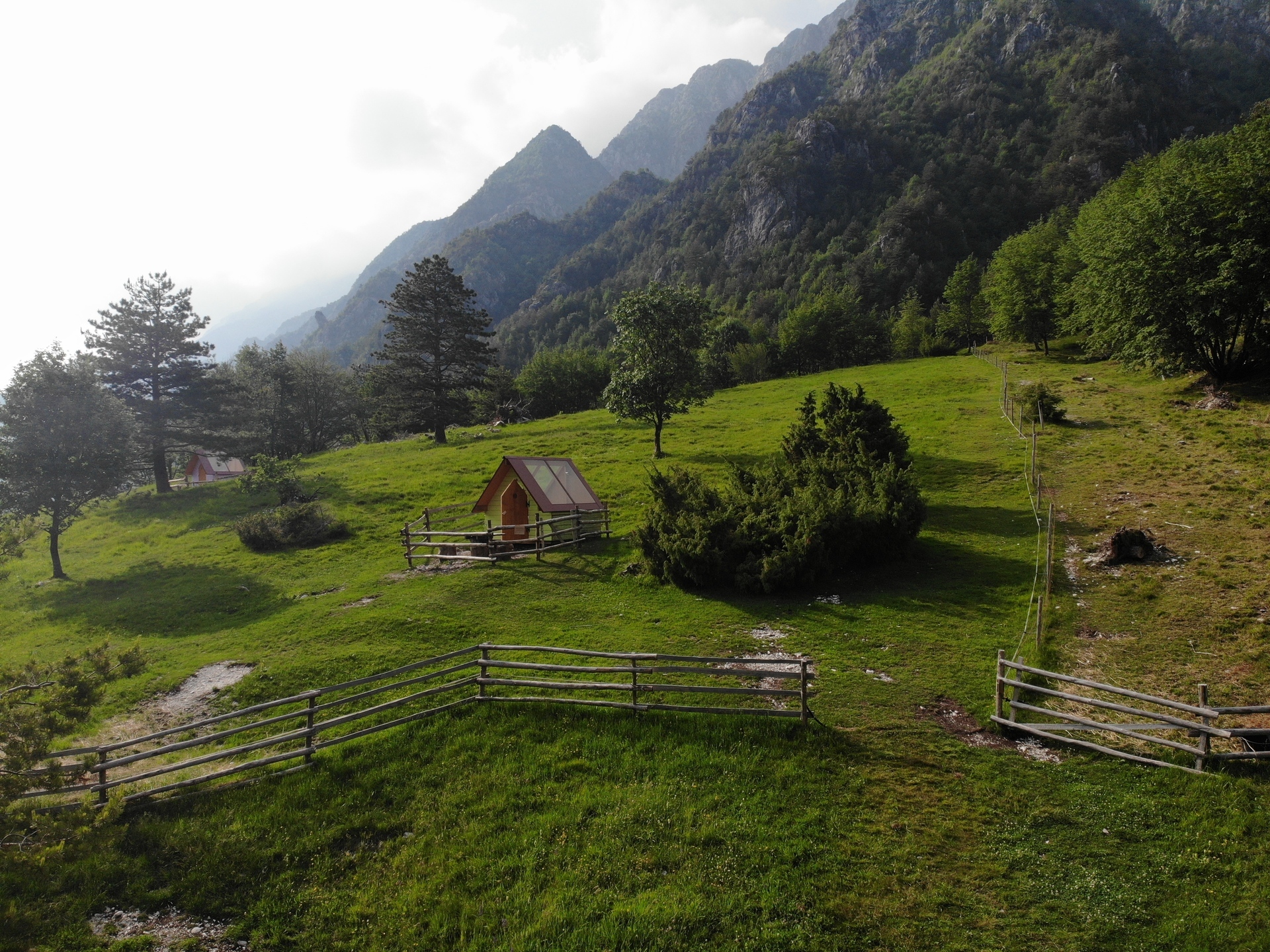
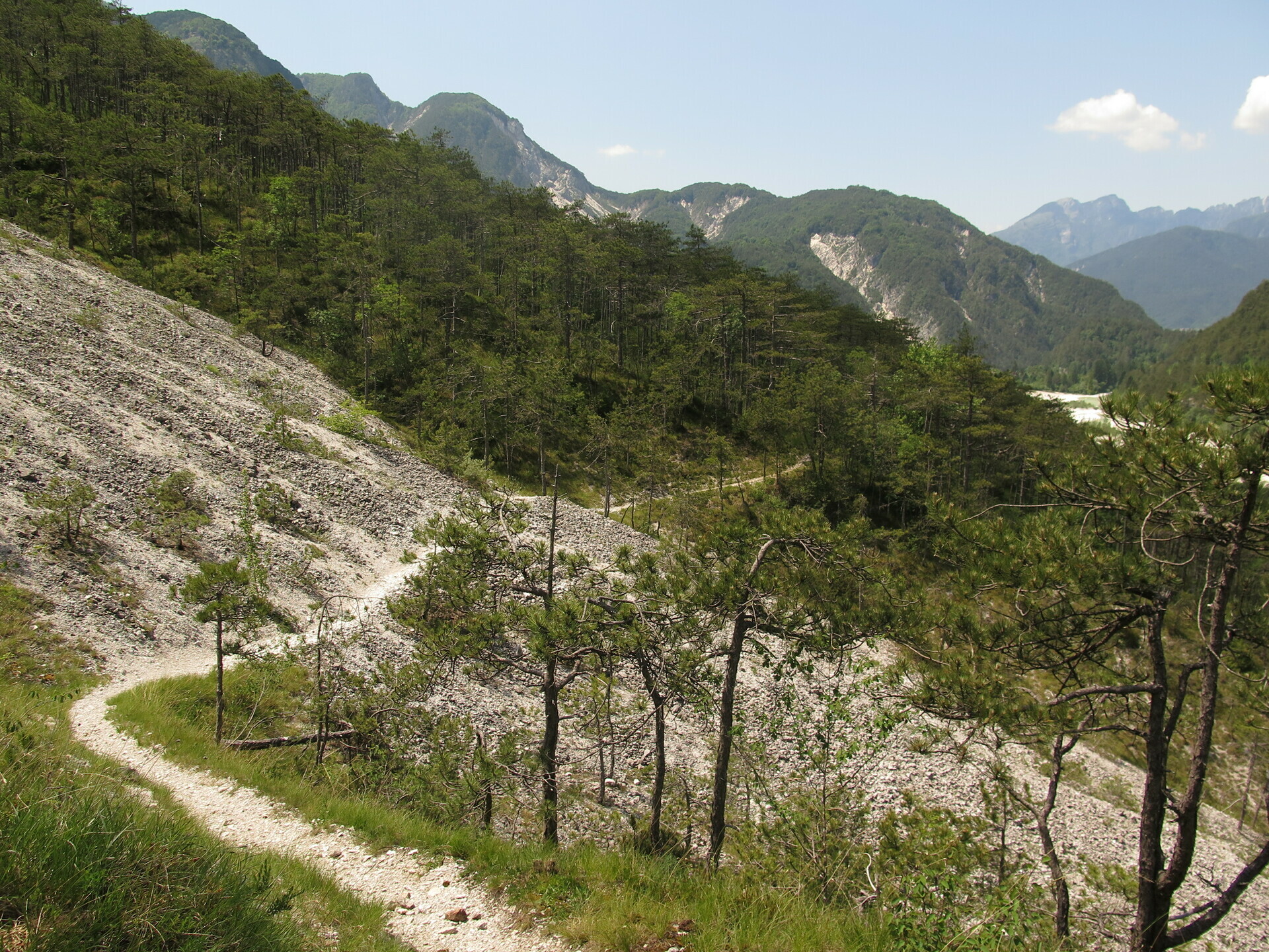
The climb to the Passo dei Ciclamici ends to descend to Uccea and climb to the Sella Carnizza. Descend into Val Resia inside the Julian Alps Natural Park where you cannot miss the detours to Fontanone Barman and Torrente Resia. The MTB Friuli style cannot be missing and the descent to the valley floor is along a path. From Resiutta, proceed along the Alpe Adria cycle path, turning towards Moggio Udinese and the road to Carnia. Secondary roads lead to Amaro first and then to Tolmezzo. After crossing the historic center you arrive at the path on the Torrente But and at the Bed and Breakfast Le Tre Colombe, Caneva di Tolmezzo.
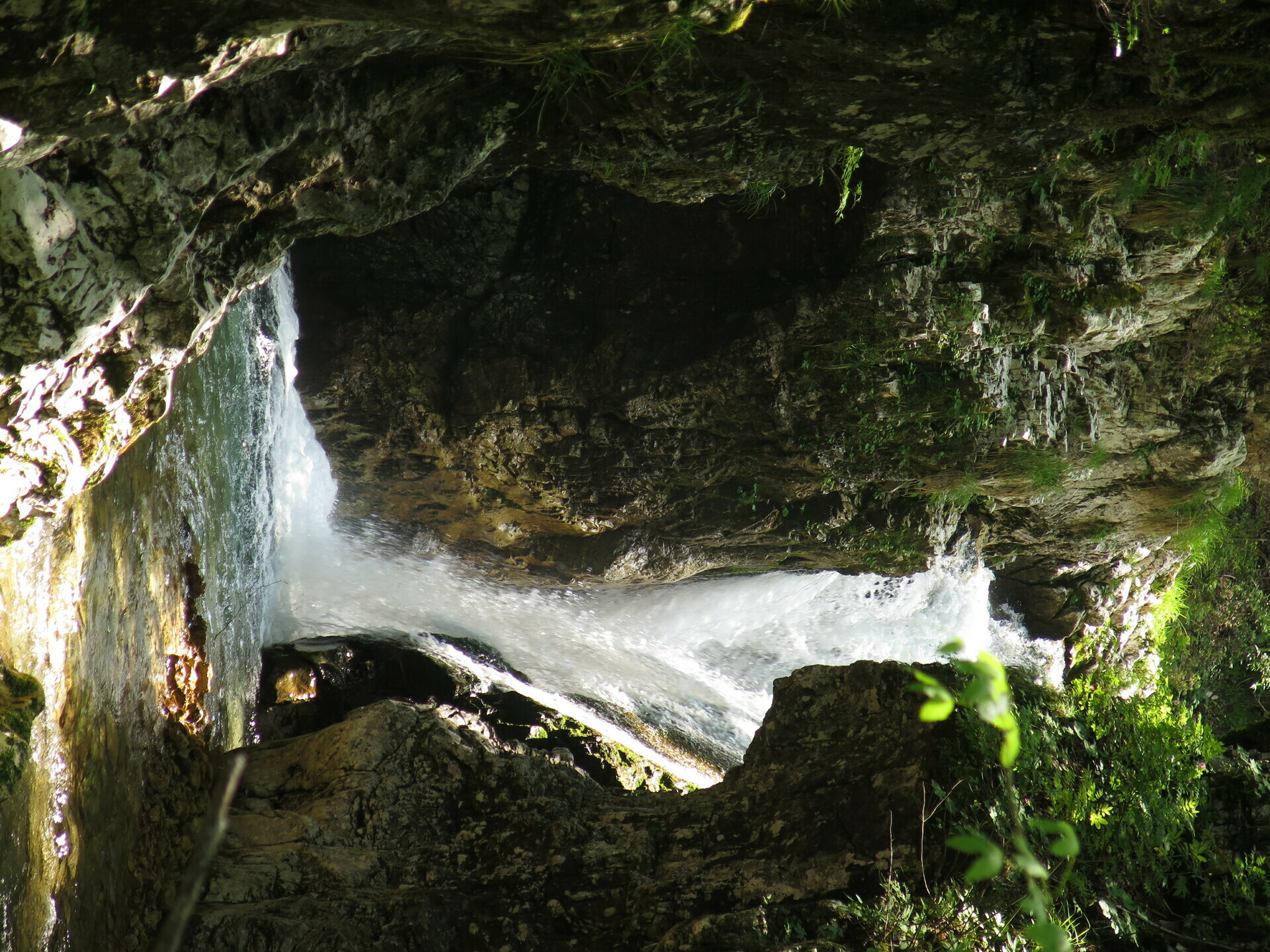
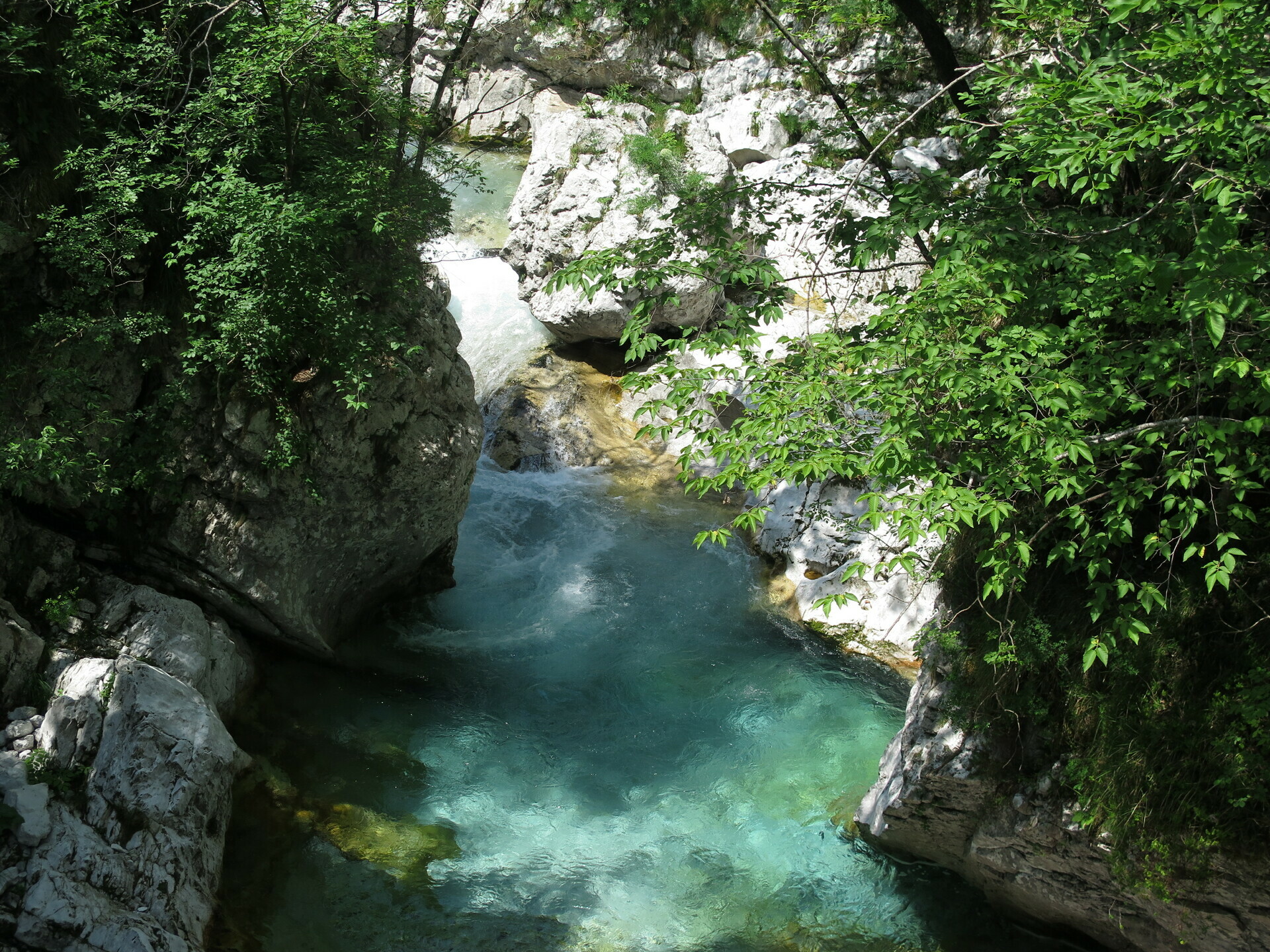
We are therefore in the Carnic Alps and we cannot miss the passage to Villa Santina, along the Tagliamento River, to then go up to the Chiampon Sella. Now continue southwards discovering and getting to know the Arzino stream, from its sources, to the waterfalls, to the gorge, at its conjunction with the Tagliamento. Then we follow this watercourse pedaling alongside it until we arrive at the beautiful historic center of Spilimbergo.
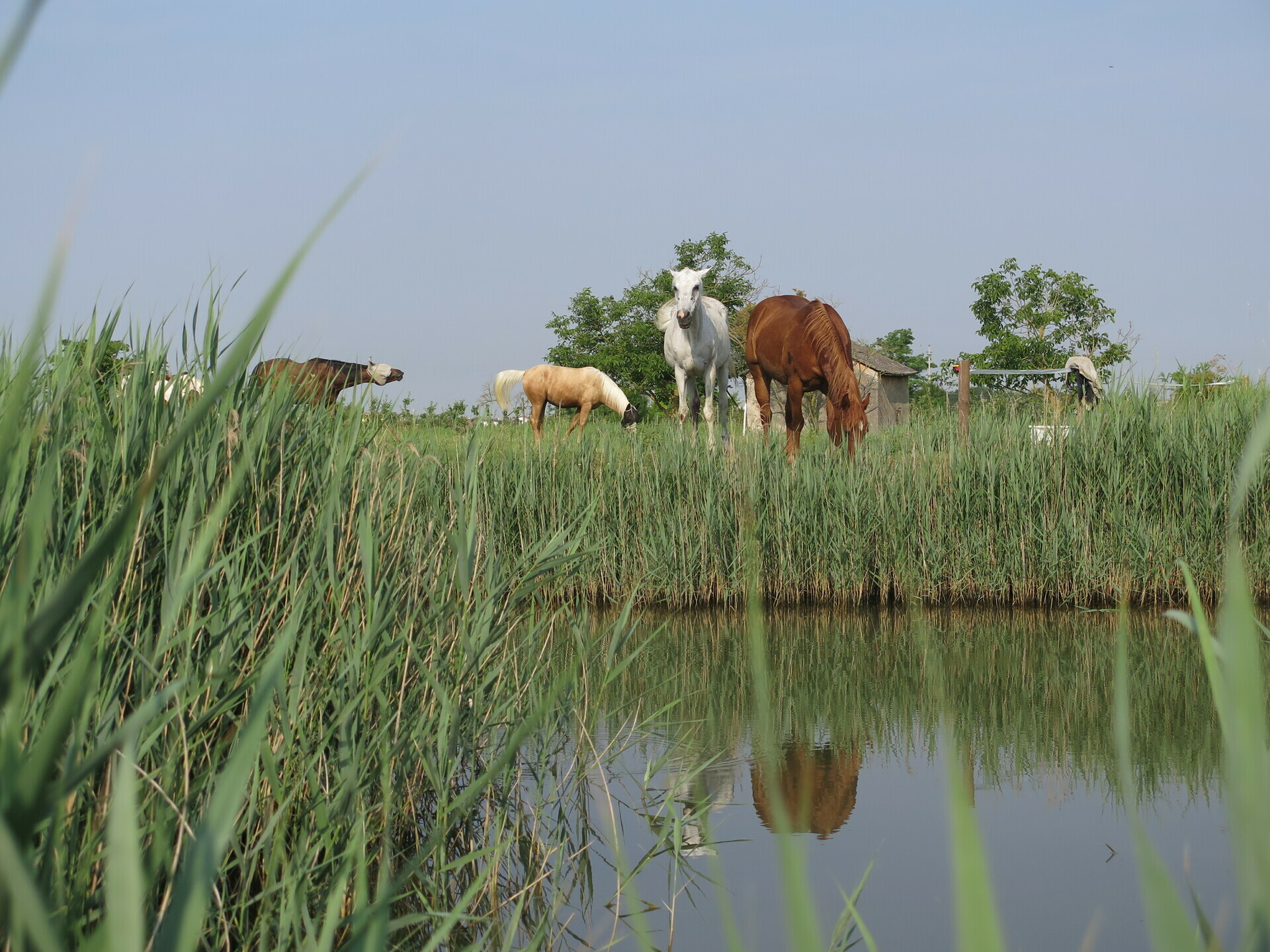
After four days in the mountains it seems time for a little rest. The stage is not short but develops almost completely on a slight descent. Inside the bed of the Tagliamento up to the height of Codroipo, you then proceed along the embankment up to the vicinity of Latisana where you turn towards Marano; all trying to move as much as possible on dirt and visiting places of interest, such as the forest of Muzzana del Turgnano and the historic center of Marano. The accommodation is just outside the latter in an area with free grazing horses, Tenuta Valle Ca 'del Lovo, Carlino.
On the sixth day the journey ends with the return to Cividale del Friuli. It starts from the lagoon to go up to the Friuli Lower Plain. After Torviscosa we reach Cervignano; the Alpe Adria cycle path leads to the historic village of Strassoldo. There MTB Friuli abandons it to pass through the village of Novacco, reaching the village of Aiello. Continue following the Celestial Way up to the vicinity of Cormons. Again MTB Friuli proceeds on its way pointing to the Bosco Romagno. Beyond this, some secondary streets lead to the historic center, Unesco heritage, of Cividale.
Given the layout, the route can be done all year round, avoiding only periods that are too hot or shortly after heavy rainfall.
Despite being the "simple" variant of the Friûl Salvadi journey, the Microcosmroute has difficulty levels not negligible physics and technique. Difference in height or length require preparation, like the different sections on the path, even more so when traveling carrying luggage.
 , Technical difficulty
 , Technical difficulty
 , Technical difficulty
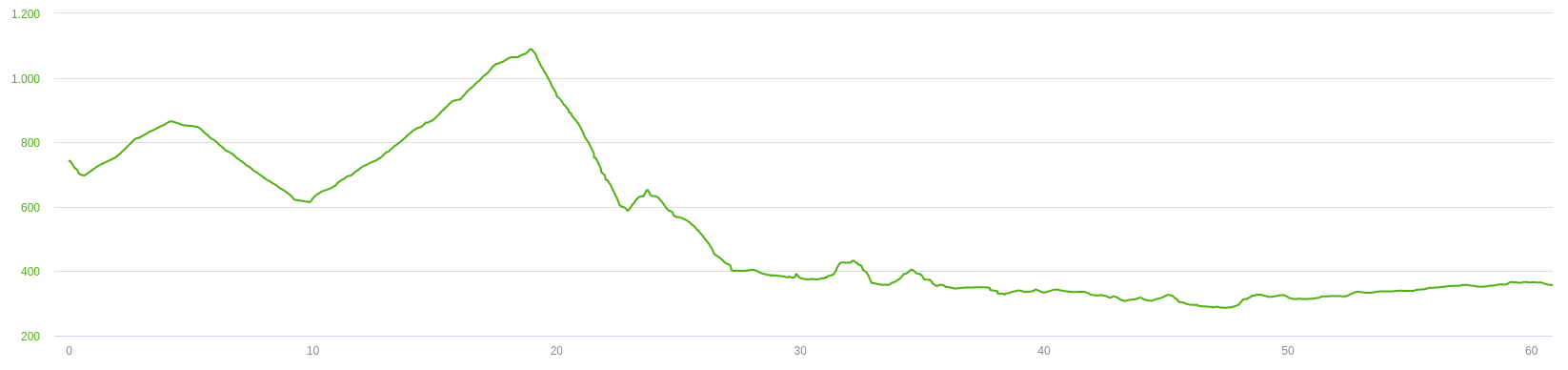
, Technical difficulty 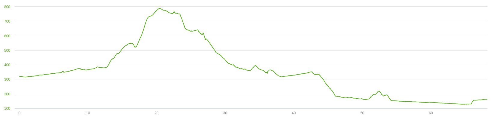
, Technical difficulty 
, Technical difficulty 

Track's picture and video
Friuli is a small territory but with an infinity inside.
With delicacy, we go to explore it becoming, in a week, part of it.
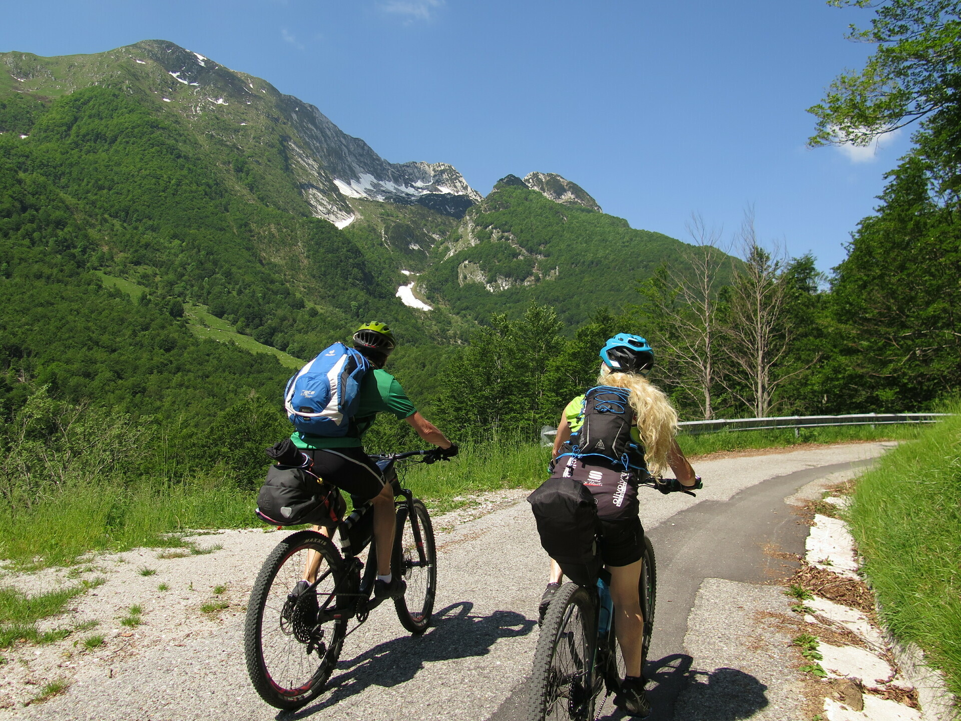
MTB Friuli travelling with trolley.
Is this couple able to move everywhere?
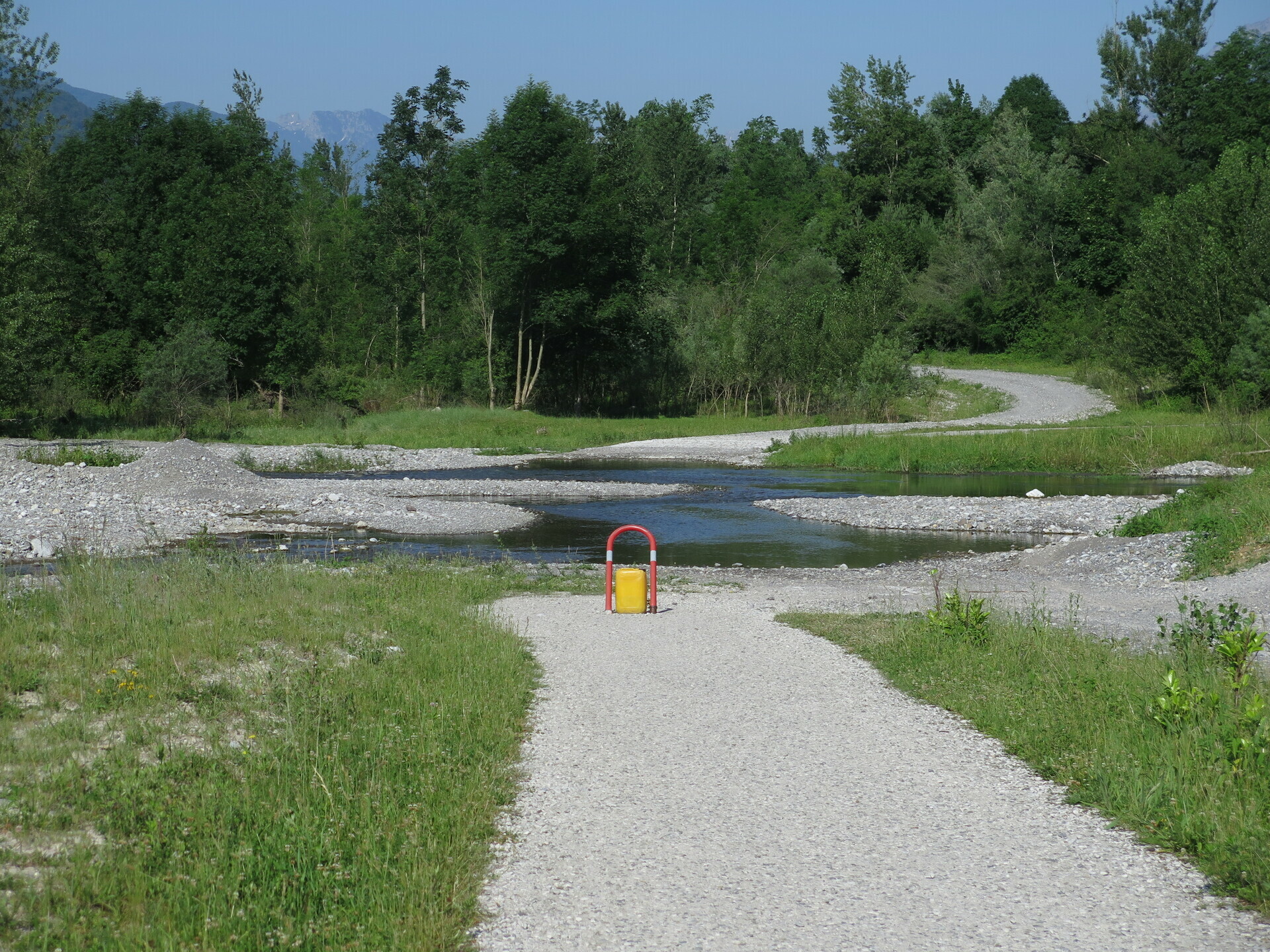
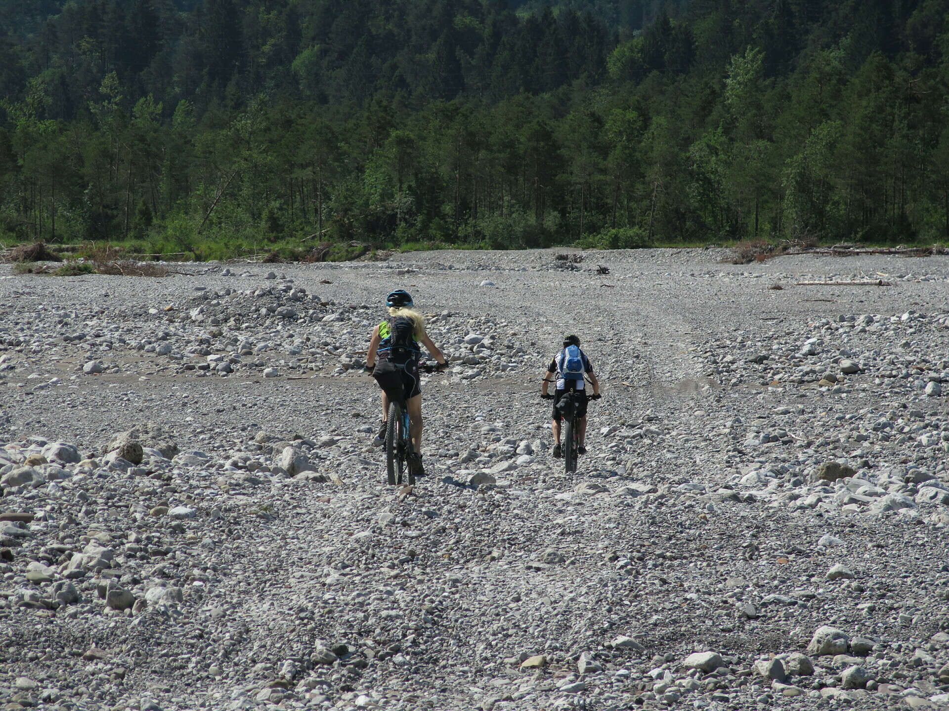
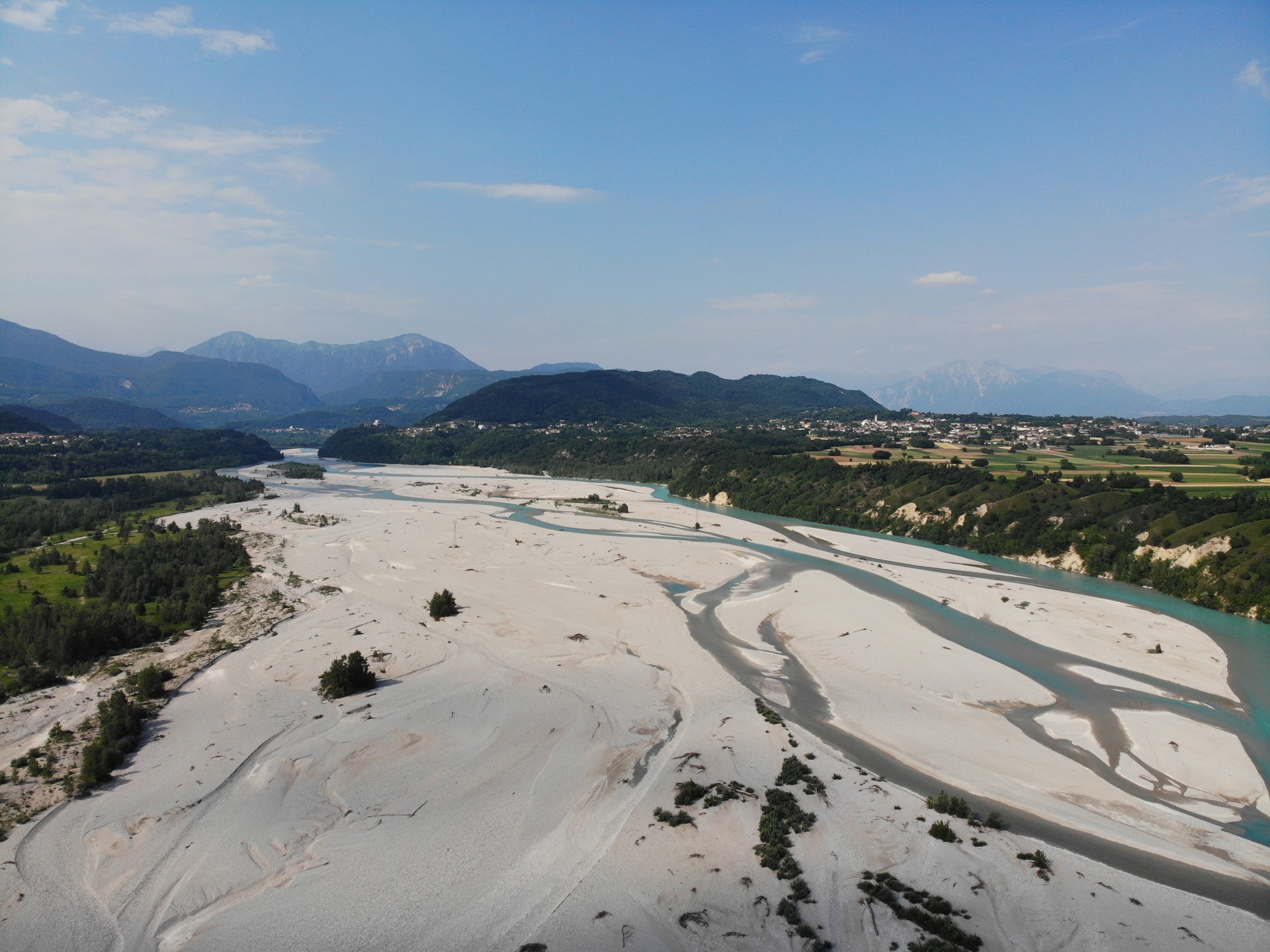
Half of the Friulian plain is crossed inside the Tagliamento.
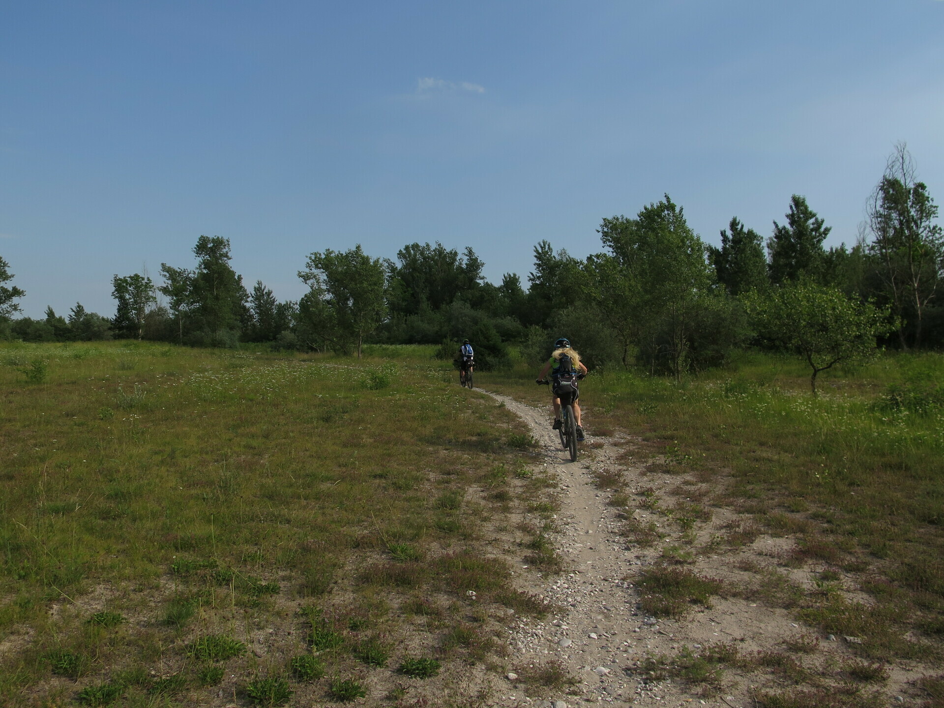
Mainly on dirt roads, several sections on paths.
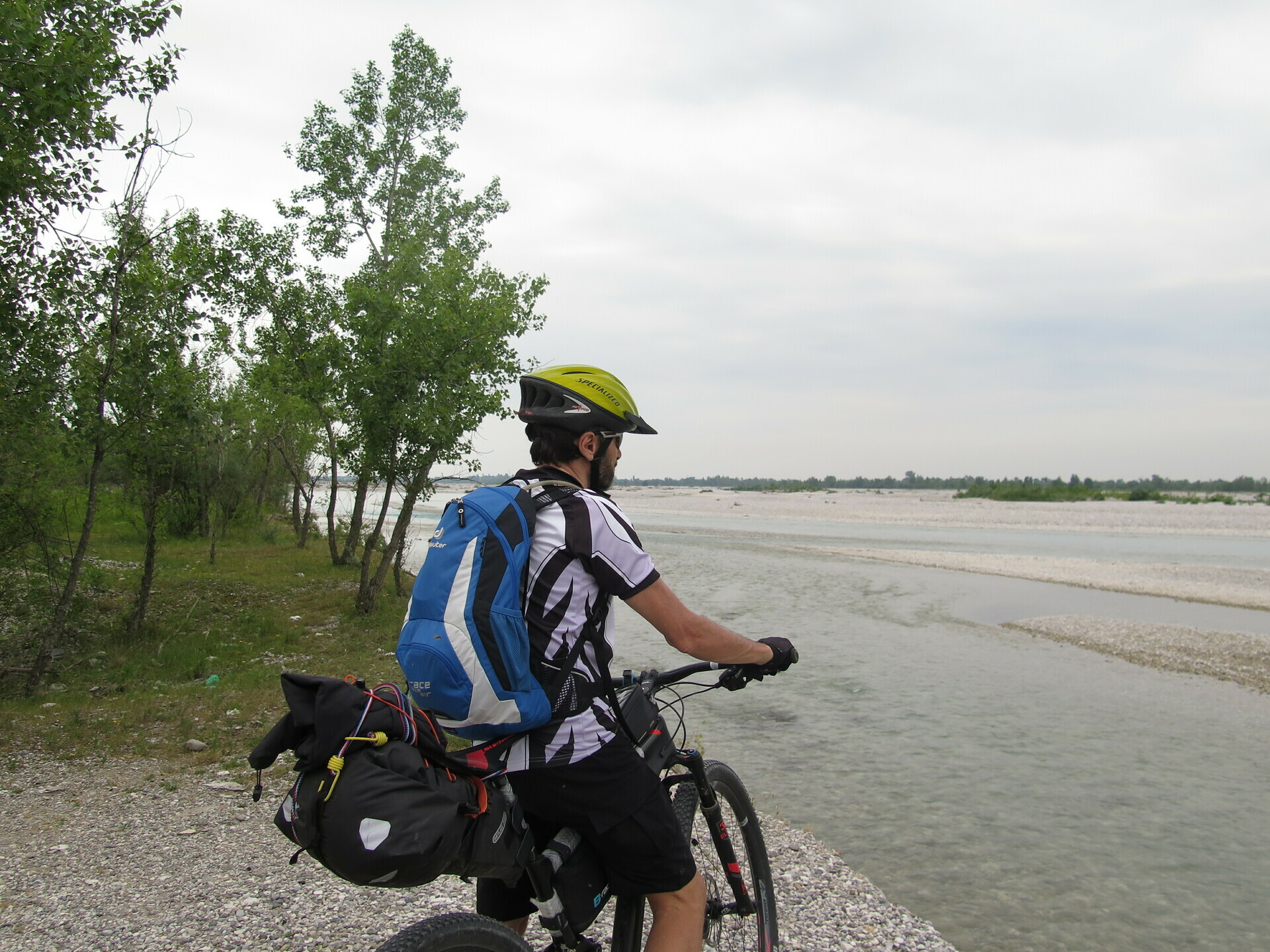
Proceed along the River of the Region, the Tagliamento.
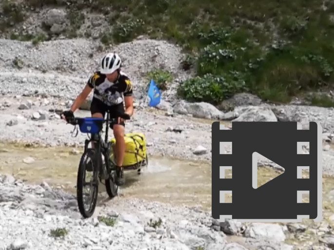
The water appears and disappears in its gravel.
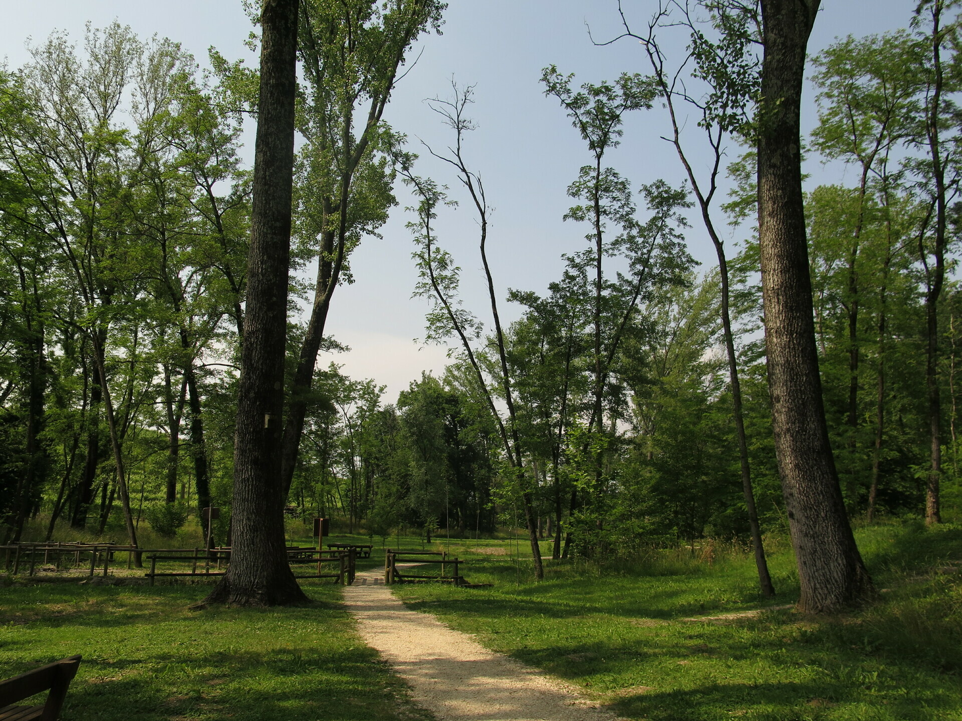
The shore contains parts covered by meadows, others by woods.
Some passages also on gravel, near the watercourse.
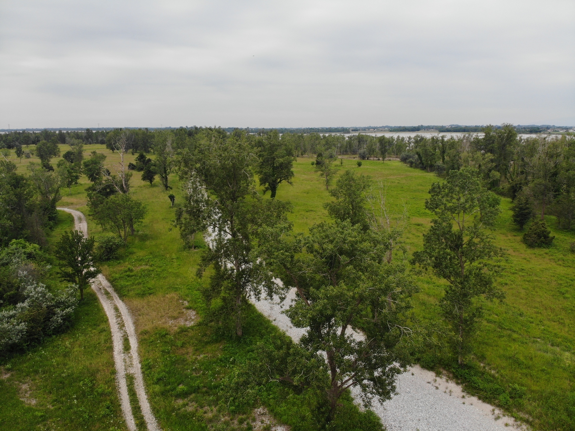
Now in the Bassa Friulana near Muzzana del Turgnano.
Pass by the last taste of the ancient forest, the Silva Lupanica .
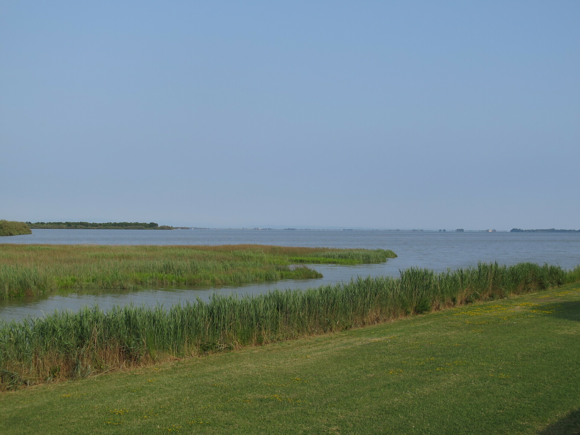
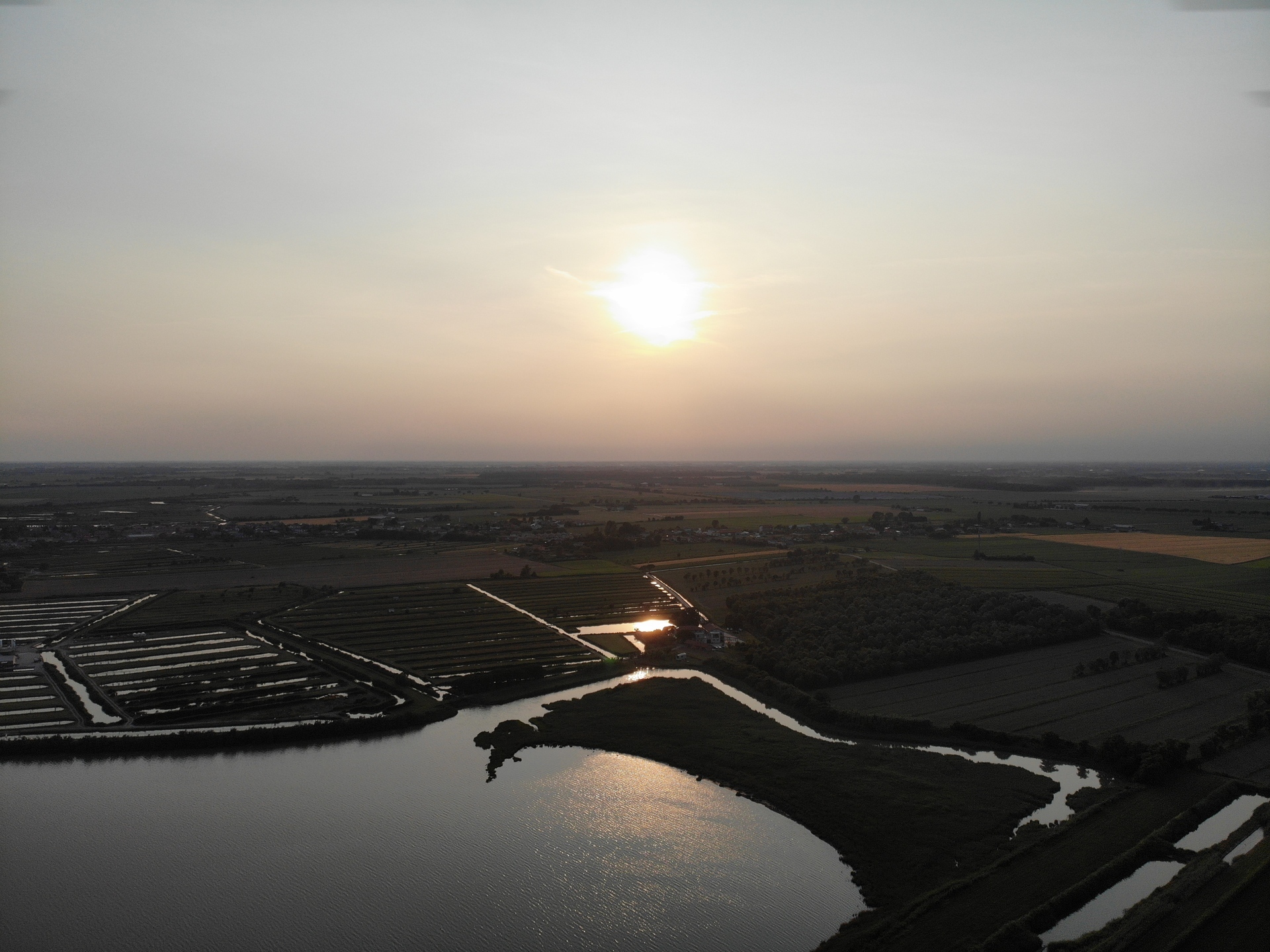
At the end of the plain, the arrival at the Marano Lagoon.
Fish tanks, horse enclosures and much more.
 .PDF Guide
 Parking
 Track
Track